


The Rancho Cañada del Oro Open Space Preserve is an interesting spot to hike to see wildflowers south of San Jose. This visit was in early February, when I didn’t expect to find much in bloom, but I was pleasantly surprised with the variety that we found.
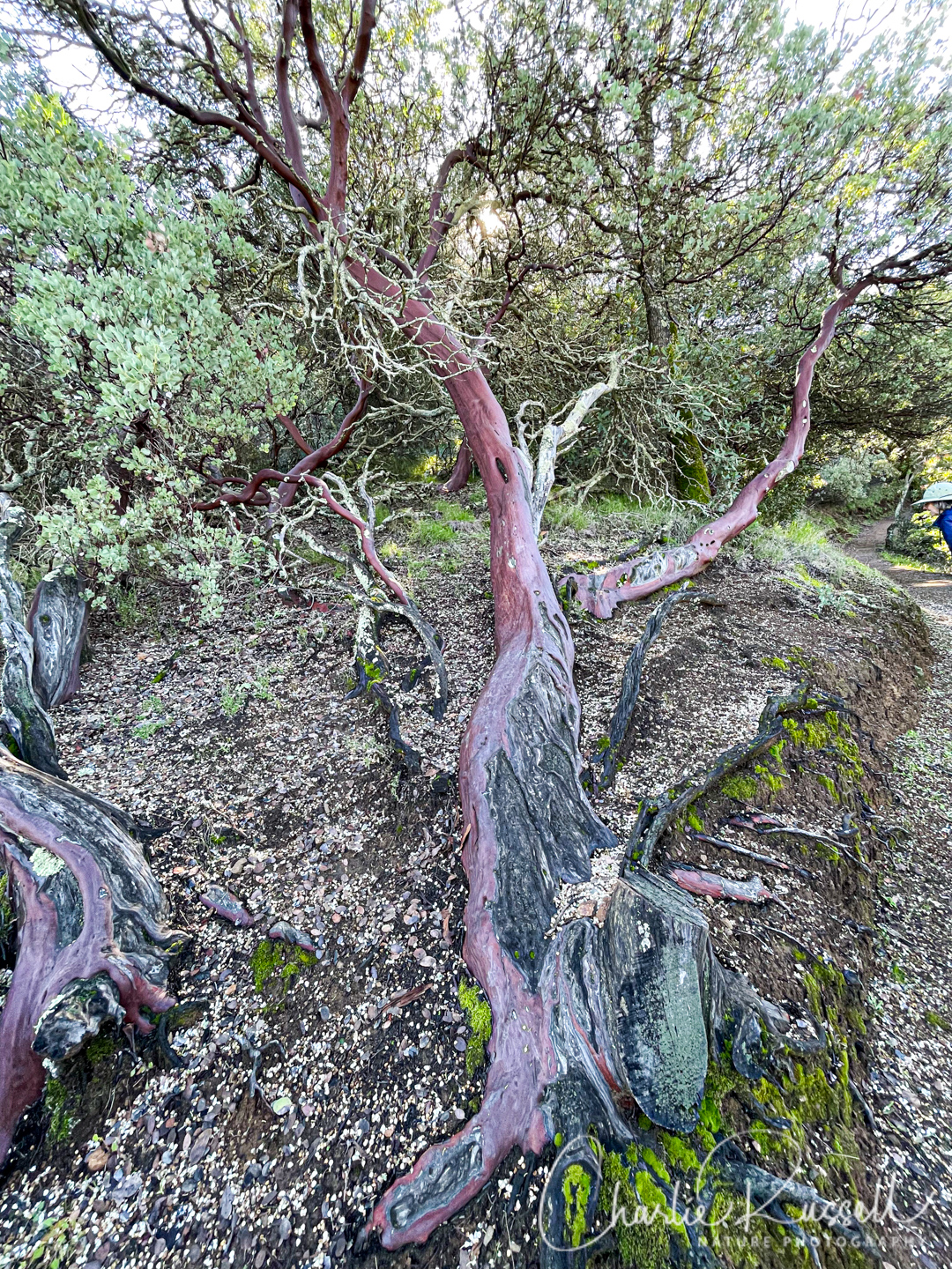
It is a great hike up into some beautiful mixed oak woodlands, with impressively large manzanita and volumes of shooting stars. We’ll be sure to come back a bit later in the spring to see all the flowers that were just starting to sprout up.
The Flowers
Here’s a sample of a few of my favorites from this hike (click on the image to see a larger view).
The star of this hike is Mosquito bill, a shooting star. On THIS visit, just a few were actually blooming, but on some shady spots high on the trail there were hundreds of them just budding out. It will be spectacular. Look in shady spots along the trail.

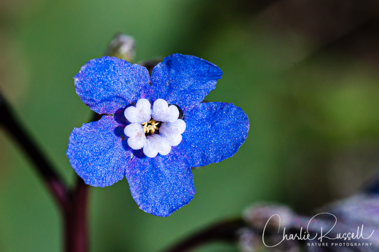
Houndstongue is one of the earlier bloomers in Northern California. The name comes from the shape and texture of the leaves. I love the intense blue of these!
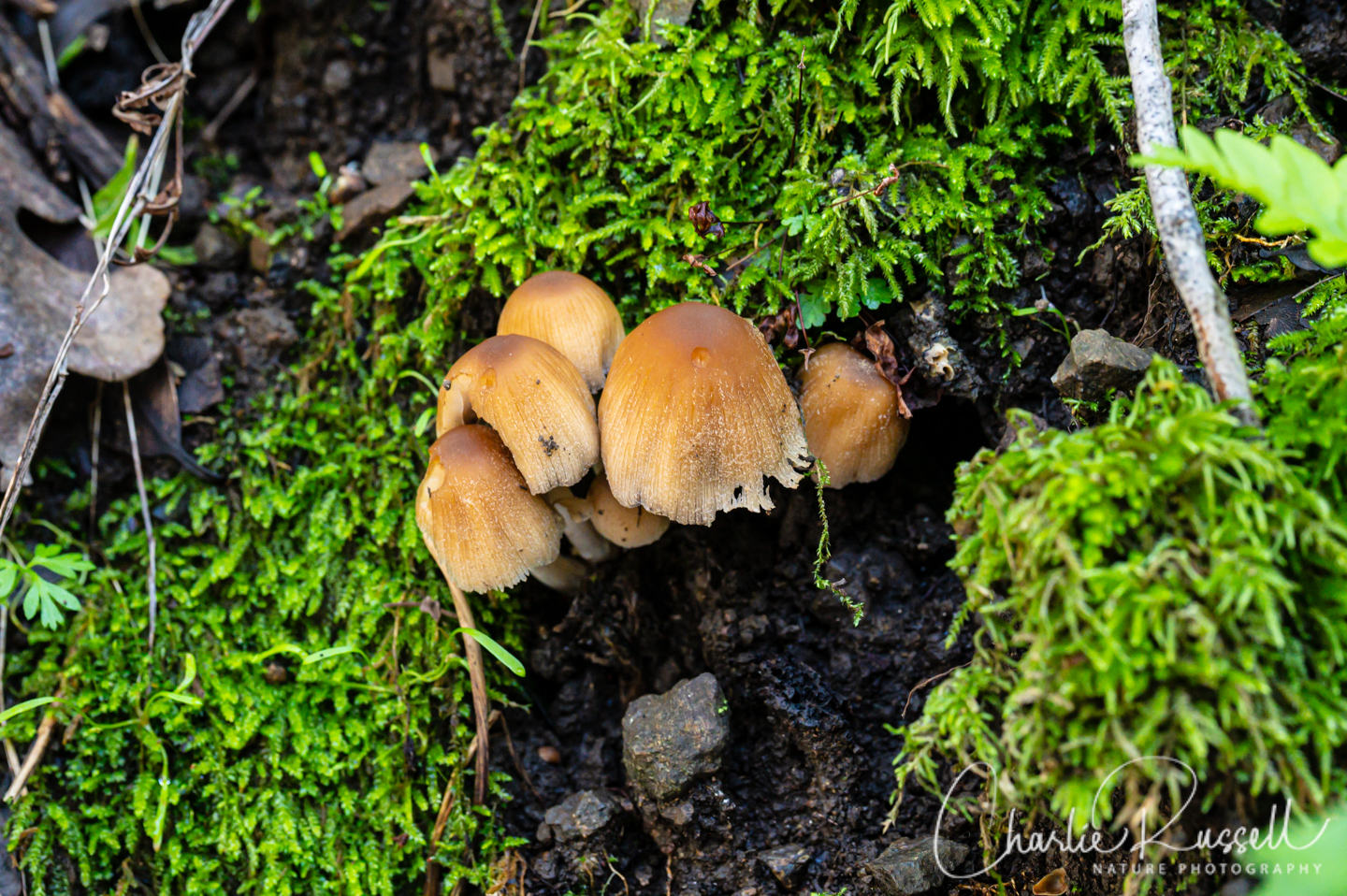
Since it had been raining recently, there was a good variety of mushrooms. Golden ear is interesting, it actually is parasitizing another mushroom, Stereum hirsutum, which you can see a few remnants of in this photo.

For the best viewing experience, click on the lightbox image below, and you can scroll through larger versions of the photos of many of the plants (and other things) that we found on this hike. All photos are available for purchase in a variety of formats.


")


, Claytonia perfoliata \"Rooreh\" is in Chochenyo, Ohlone languag")


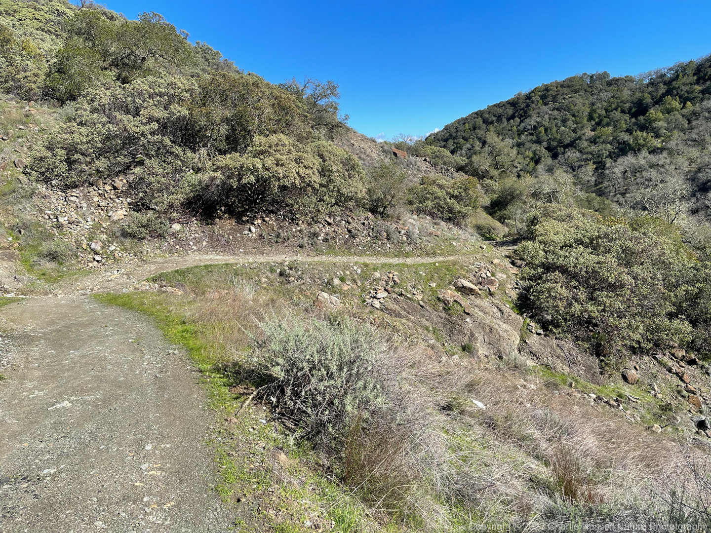
The Hike
There are several trails at Rancho Cañada del Oro. On this visit we went up the Mayfair Ranch trail, climbing up the ridge, and then came back on the Longwall Canyon trail. This loop trail was a bit over 4 1/2 miles with about 700′ of elevation gain.

We visited the first week of February 2023, just a day or so after rain, and there were several spots where the trail was a bit muddy, but it wasn’t a problem. There are several seasonal streams that you cross, some with bridges and some without. There was only one were you might get your boots wet (on this visit), and we were able to dance across the rocks without any problem.
The trail is mixed use with hikers, bikers and equestrian. It is well maintained and reasonably wide.
The start of the trail is to the west of the parking lot, past the horse trailer parking.
There is another trail that just loops through the meadow (which we didn’t try).
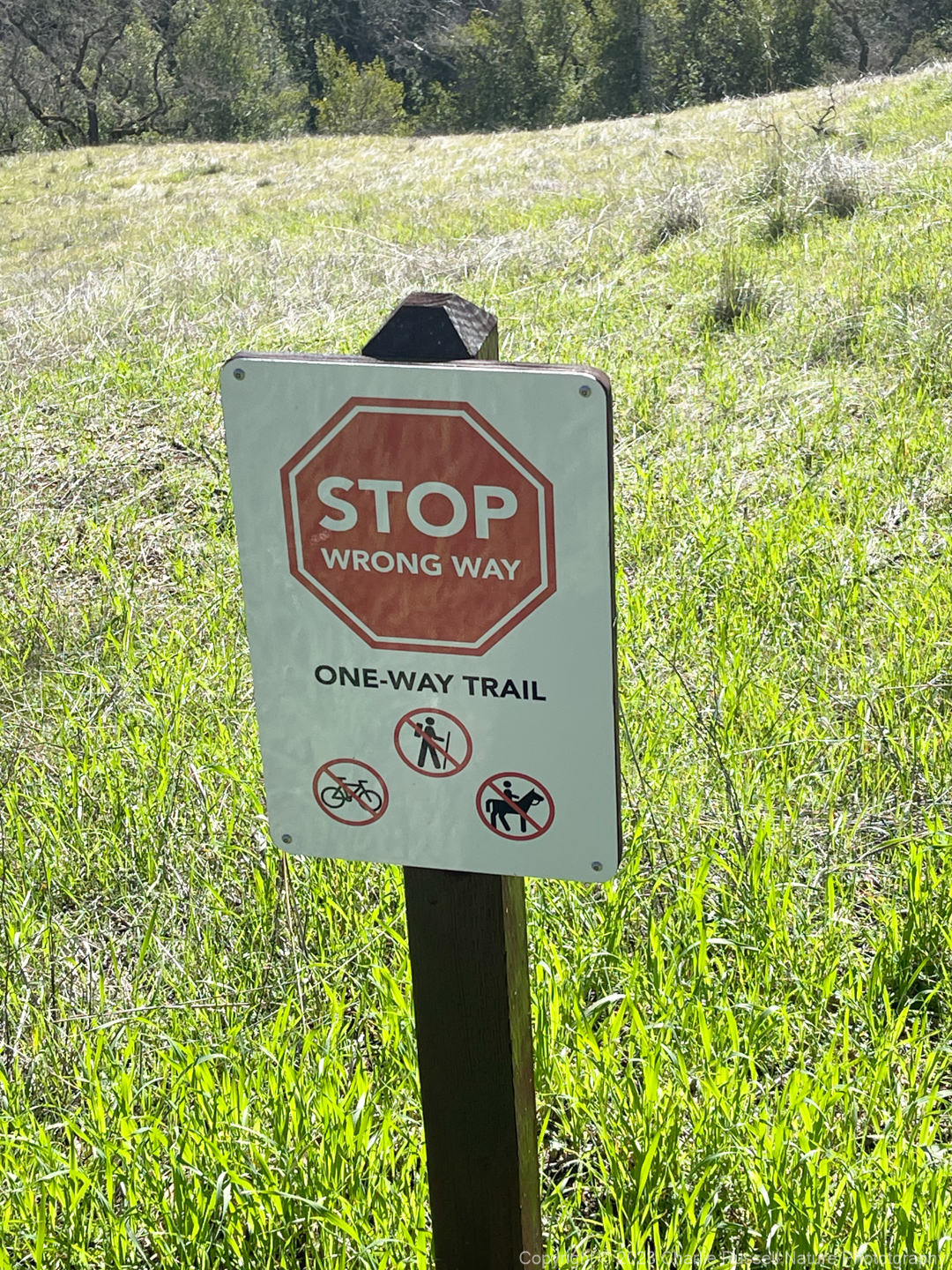
Note that you are required to hike in a clockwise direction on this trail. You also should check the Santa Clara Valley Open Space Authority website for information about trail conditions, as sometimes the trails are closed.
You may see signs telling you that you are going the wrong way.
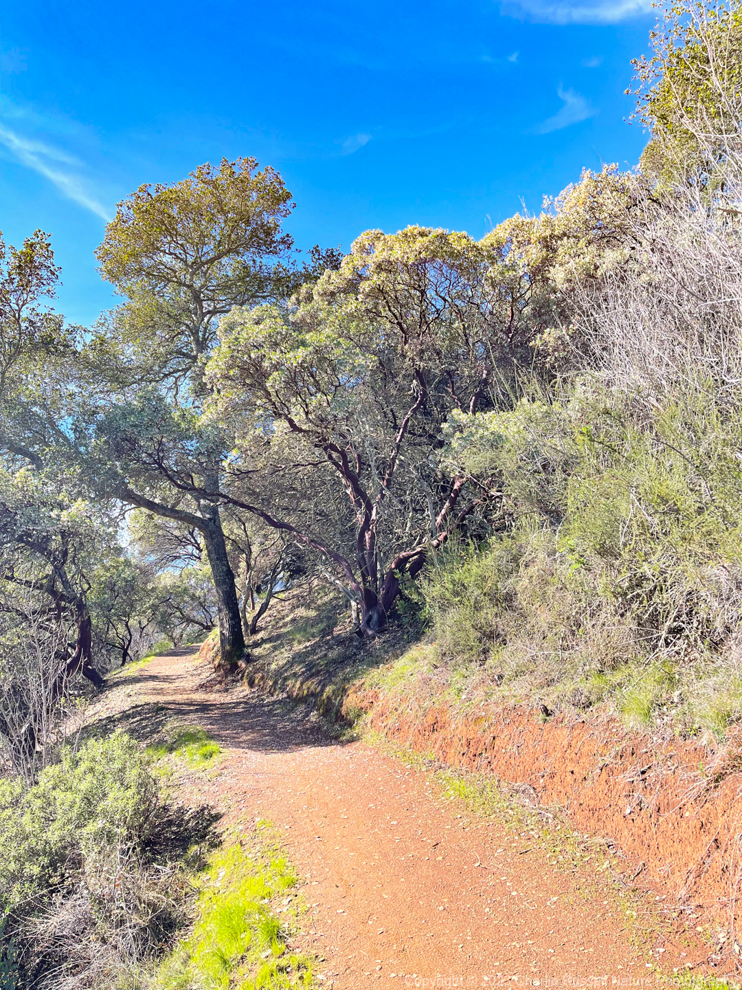
The hike up the Mayfair Ranch trail was the most interesting as. HUGE manzanita bend over the trail. It was shadier, not too exposed, except for some spots higher on the ridge.
On this hike, most of the wildflowers were along this trail, as you climb up to the ridge, and just past the high point as you start back down.
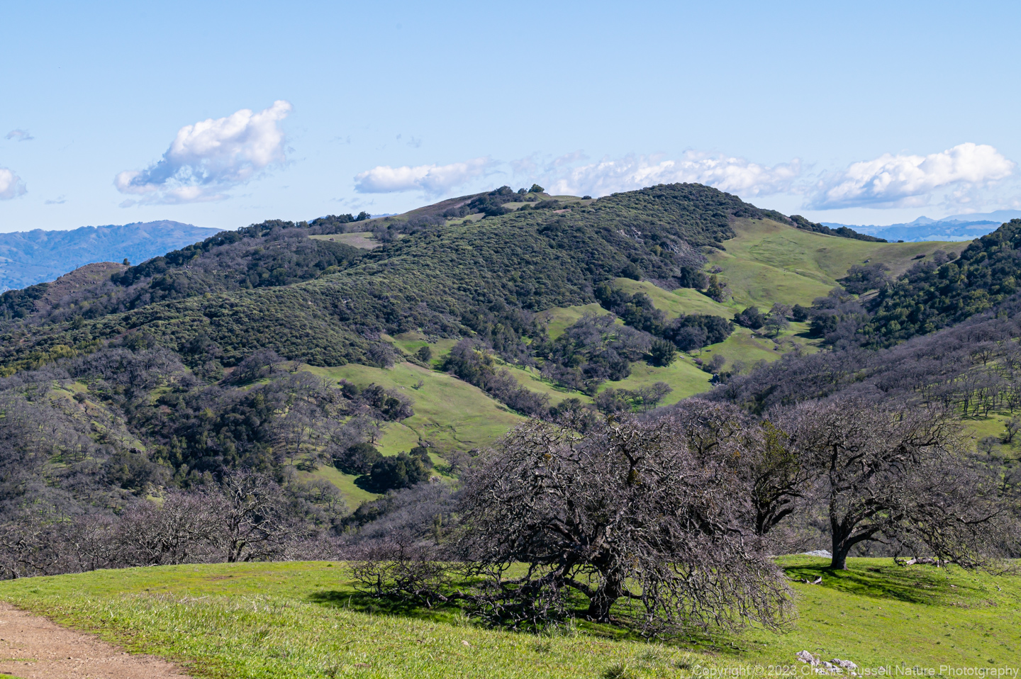
After about a mile and a half in to the hike things open up, as you start hiking up the backbone of the ridge. There are some great views of the mixed oak woodland from here.

At 2.2 miles there is a nice picnic table, with a reasonable view. This is close to the top of the climb. From here you will start downhill on some gentle switchbacks. Lots of wildflowers along this section, including tons of shooting stars (most were just in bud on this visit).
Around 3.2 miles you reach the Longwall Canyon trail, which takes you back to the trail head (Casa Loma Staging Area on signposts). This wasn’t as flowerful, as it is drier and more exposed. But there are some serpentine areas along the way, which may have some interesting plants.
Here’s the track that we followed:
Rancho Canada Del Oro
Profile
Trail junction
Description
Move your mouse along the elevation graph to show the location on the map. The Refresh icon will re-center the map. The Expand icon will expand to full screen
Directions
The Rancho Cañada del Oro Open Space Preserve is south of San Jose, CA. From Highway 101 take exit 373 and go west on Baily Avenue for 3 miles, until it ends at McKean Rd. Turn left (south) on McKean Rd for 2.4 miles, then turn right on to Casa Loma Rd. After 1.7 miles you will see the parking lot for Rancho Cañada del Oro Open Space Preserve on your left.
There is a pit toilet there, but it was cordoned off on this visit. A porta-potty was available. There is plenty of parking, at least on a weekday, since there is space for horse trailers for the equestrians.
Timing is Everything
We had a beautiful day for a hike in February, clear and sunny. It was a bit chilly (hey, it is still winter!), with temperatures staying in the low to mid 50’s. There was a breeze that made it feel colder when you were in an exposed area, maybe 10 to 12 mph. Enough to annoy me when taking a flower photo.
This visit was on a weekday. Very few people on the trail, only a couple of hikers and a few bikers that we saw in the parking lot. I suspect it will be much busier when it warms up and the flowers are in full bloom. I’ve seen notes about the parking lot being crowded on weekends.
Rancho Cañada del Oro Wildflowers
Here’s a listing of the native plants that we found on this visit.
The ones listed in color are endemic to California (that is, found only in the California Floristic Province). “nif” means “not in flower”. CNPS numbers are ratings for rare plants by the California Native Plant Society (see my explanation of CNPS ranks). In most cases the scientific name will be a link to a reference source such as Calflora.
- Big berry manzanita, Arctostaphylos glauca
- Blue witch nightshade, Solanum umbelliferum
- California bay, Umbellularia californica
- California buttercup, Ranunculus californicus
- California maidenhair fern, Adiantum jordanii
- California man-root, Marah fabacea
- California Polypody, Polypodium californicum
- California poppy, Eschscholzia californica
- Chamise, Adenostoma fasciculatum (nif)
- Checker Lily, Fritillaria affinis (in bud, nif)
- Climbing bedstraw, Galium porrigens
- Coastal wood fern, Dryopteris arguta
- Coffee fern, Pellaea andromedifolia
- Common Yarrow, Achillea millefolium (nif)
- Dendroalsia Moss, Dendroalsia abietina
- Gold back fern, Pentagramma triangularis
- Hillside gooseberry, Ribes californicum var. californicum
- Lupine (nif)
- Milkmaids, Cardamine californica
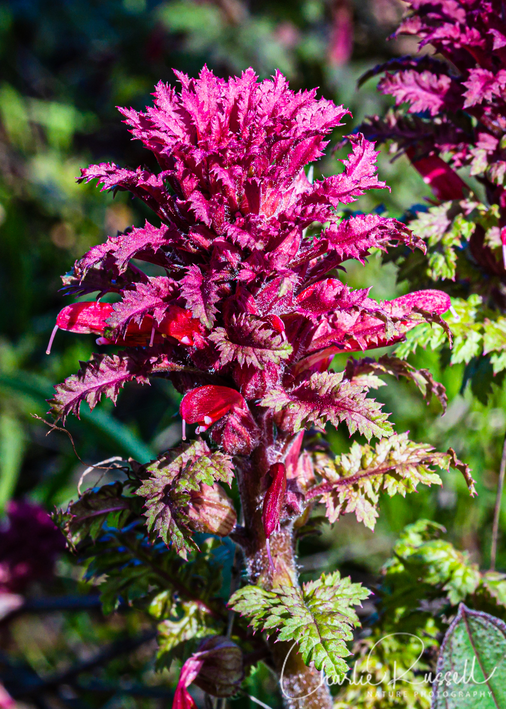
- Mosquito bill (aka Henderson’s shooting star), Primula hendersonii
- Oregon Beaked Moss, Kindbergia oregana
- Pacific houndstongue (aka Adelinia), Adelinia grandis (formerly Cynoglossum grande)
- Pacific sanicle, Sanicula crassicaulis (nif)
- Poison oak, Toxicodendron diversilobum (nif)
- Red maids, Calandrinia menziesii
- Redberry buckthorn, Rhamnus crocea (nif)
- Rooreh (aka Miner’s lettuce), Claytonia perfoliata “Rooreh” is in Chochenyo, Ohlone language
- Santa Clara valley dudleya, Dudleya abramsii ssp. setchellii . CNPS 1B.1, FE
- Toyon, Heteromeles arbutifolia (nif)
- Trillium (nif)
- Warrior’s plume, Pedicularis densiflora
- Wavyleaf soap plant, Chlorogalum pomeridianum (nif)
- Yerba buena, Clinopodium douglasii (nif)
The following are some of the flowering non-native plants that we found on the hike as well:
- Chickweed, Stellaria media
- Redstem filaree, Erodium cicutarium
We also found the following:
- Artist’s conk, Ganoderma brownii
- California Towhee, Melozone crissalis
- Golden Ear, Naematelia aurantia
- Hairy Curtain Crust, Stereum hirsutum
- Lilac Bonnet, Mycena pura
- Speckled Greenshield Lichens, Flavopunctelia sp.
- Stinking Orange Oyster, Phyllotopsis nidulans
- Turkey-Tail, Trametes versicolor
- Wild Turkey, Meleagris gallopavo


I’m so happy you’re back! I’ve been thinking that it’s about time to start wildflower hikes again, and here’s your newsletter. Yayyy!
I love your pictures and always take my camera along, but often have trouble getting enough light without having the flowers move. Do you use a light, and if so, would you mind telling me what you use?
Thanks again,
Joanna A.
I rarely use a light, but if I have to I will use an LCD light panel, See the Neewer light panel on my equipment page.
My Nikon D780 works very well in moderately low light, so I’m not using the light panel that often these days.