


Blue Canyon is an interesting trail in the Sierras, close to Sonora Pass. This is a vigorous hike, particularly if you aren’t acclimated to the altitude.
It can be difficult to find the trailhead, as there are no signs or markers.
There is a great variety of native wildflowers here, and it is worth the long drive to see so many wildflowers late in the summer.
The Flowers
Here’s a sample of a few of my favorites from this hike (click on the image to see a larger view).
Narrow tube ipomopsis is the paler cousin to scarlet gilia (Ipomopsis aggregata) which I see more often in the Sierras. There was more of this than I’ve ever come across before, in several spots part part way up the mountain.
There was a nice patch of Western polemonium (aka Western sky pilot) along the stream that you cross near the beginning of the hike.

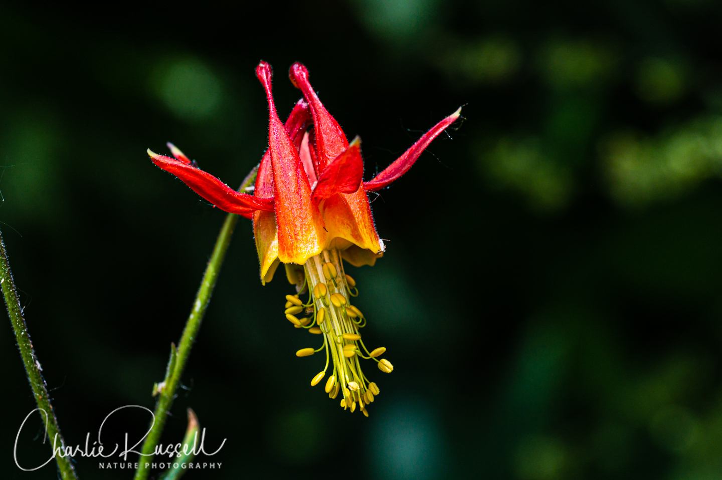
I’m always happy to find western columbine on a hike, but it was surprising to see this so late in the year!
We didn’t find too many Leichtlin’s mariposa lilies this time, but they do stand out on the exposed rocky hillsides.

/If you click on the lightbox image below you will see larger versions of the photos, and you can scroll through through a selection of the plants (and other things) that we found on this hike. All photos are available for purchase in a variety of formats.
")


")


, Allium validum")

, Agastache urticifolia")


, Trifolium productum")


The Hike
The full trail is a 3.2 mile out-and-back hike with an elevation gain of 1200′, starting at 8800′ elevation. That is a very vigorous hike! There is an interesting lake at the top of the hike.
For this visit, we only did a 1.5 mile hike. We weren’t acclimated to the altitude, and by the time we got part way up the clouds were rolling in, with thunder not too far off. We were smart enough to turn around, and just after we reached our car there was a huge cloudburst that drenched everything. You don’t want to hike in the Sierras when summer lightning storms arrive!
Here’s a view of the trailhead on Highway 108, from a hillside higher up the trail.
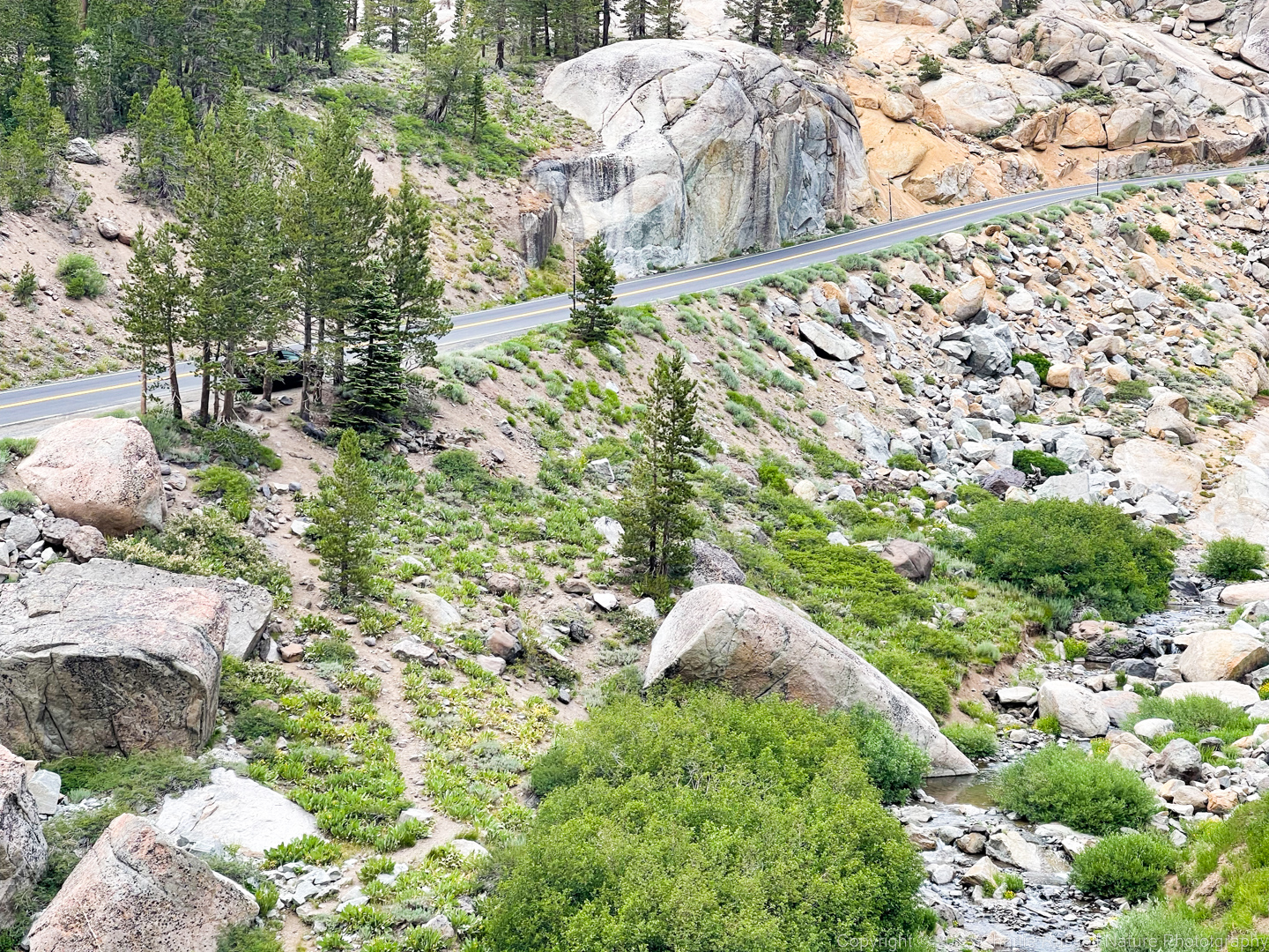
The trailhead is hard to find. There is just a spot along the road that has a wider than usual shoulder. The trail starts steeply down the hill to Deadman Creek, and then straight up the opposite hill (from where this photo was taken). From the road, it is difficult to see the trail unless you are standing right at the spot.

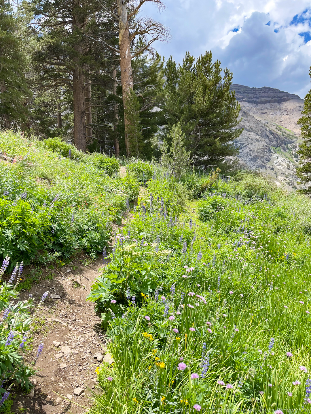
Because this is a remote and hard to find trail, it isn’t very busy. There was a great variety of wildflowers just in that first mile or so. If you make it up to the lake, you’ll find many other species beyond what I list below.
This time of year there isn’t a lot of water in Deadman Creek, so it was easy to cross. We found quite a few wildflowers blooming along here.
Looking south up the slope you’ll see the trail (faintly) heading up the hill on the opposite side of the creek.
As you go up the slope there are several spots that are very lush, with a great variety of wildflowers.
The one hiker we met when he was coming down said that this was “the best hike EVER!”
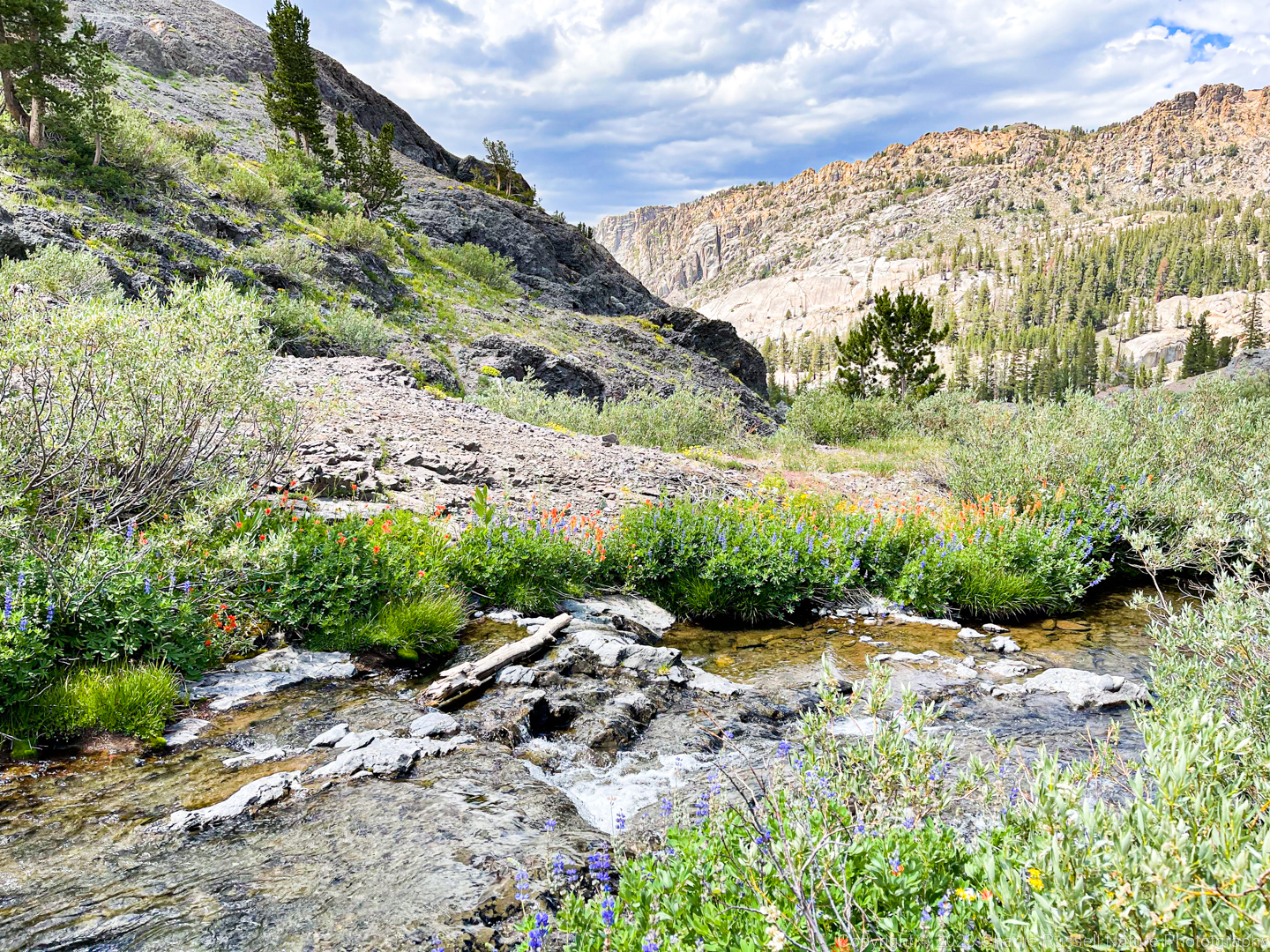
We did have one additional stream crossing further up the hill, but water levels were low enough to not be a problem. This stream will take you to Blue Canyon Lake, if you can make it that far.
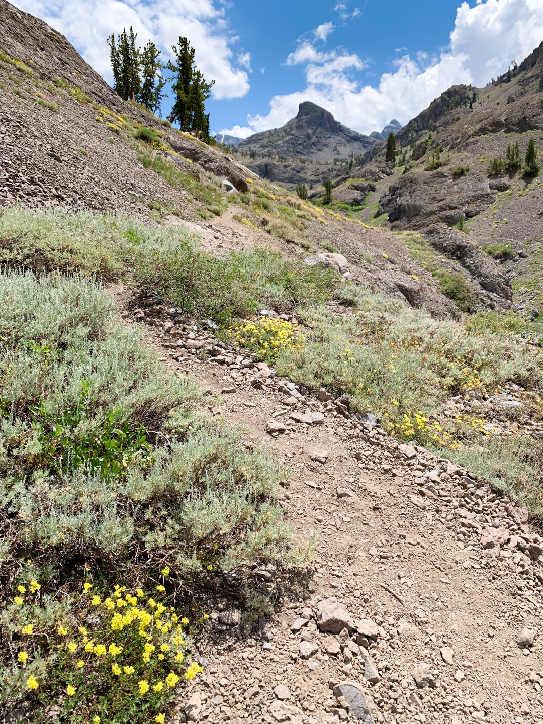
You will find a different collection of wildflowers out here.
One of the great aspects of this hike is that there are VERY few non-native plants in this area!
Here’s the track that we followed:
Blue Canyon
Profile
Move your mouse along the elevation graph to show the location on the map. The Refresh icon will re-center the map. The Expand icon will expand to full screen.
Directions
The trailhead is on Highway 108, roughly 60 miles east of Sonora, just short of Sonora Pass. It is hard to spot! There is just a wider than usual shoulder with a few trees, about 6.4 miles east of the turnoff for Kennedy Meadows Road. My recommendation is that you use an app like Google Maps and set the target location to the GPS coordinates of 38.318919, -119.663789. Keep in mind that you might not have cell phone coverage here, so it helps to download the map for the area before you head off from home.
When you get out of your car and look down the slope towards the creek you should be able to see the start of the trail.
Timing is Everything
We visited here in late July 2022. The stream crossings were not a problem, although there were some slick spots. You do have to watch the weather, as you are somewhat exposed on this hike and lightning/rain can build up quickly in mid to late summer.
Temperatures started in the upper 70’s when we arrived (after lunch, we got a late start), but quickly dropped down to the low 60’s as the clouds came in.
At this altitude this isn’t a springtime hike. Late June might work, July should be great. On this visit it looked like we were hitting the end of the flower season at the lower end of the trail. Other people who hiked this trail about the same time said that things were fresher up by the lake.
Blue Canyon Wildflowers
Here’s a listing of the native plants that we found on this visit. “nif” means “not in flower”. In most cases the scientific name will be a link to a reference source such as Calflora.
- Alpine pearlwort, Sagina saginoides
- Alpine shooting star, Primula tetrandra
- Brewer’s aster, Doellingeria breweri (formerly Eucephalus breweri)
- Bridge’s penstemon, Penstemon rostriflorus
- Brook saxifrage, Micranthes odontoloma
- California corn lily, Veratrum californicum var. californicum (nif)
- Common cowparsnip, Heracleum maximum
- Copeland’s owl’s clover, Orthocarpus cuspidatus ssp. copelandii
- Coulter’s fleabane, Erigeron coulteri
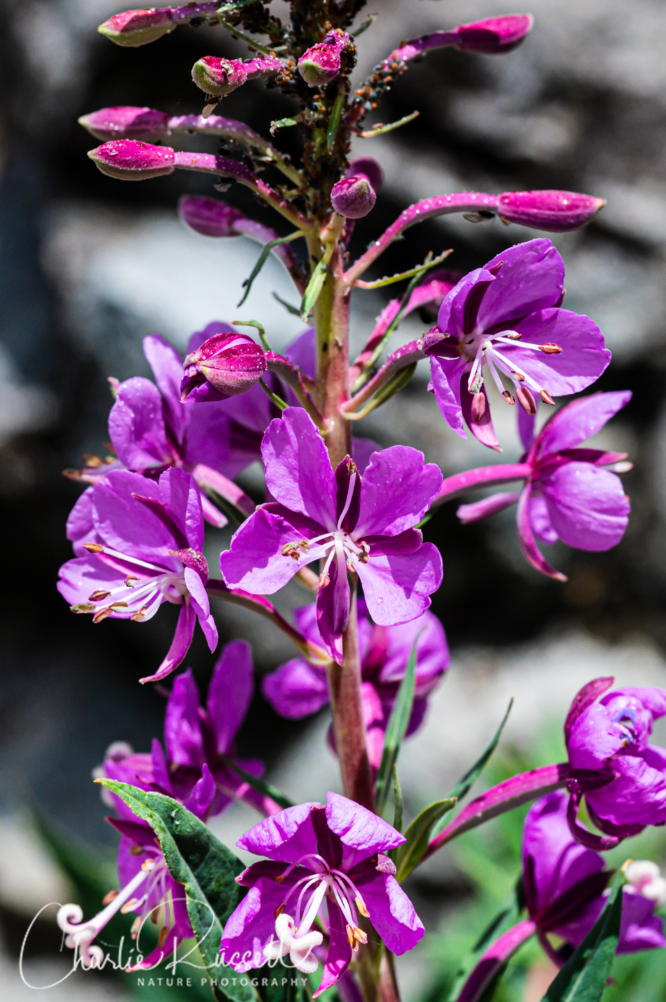
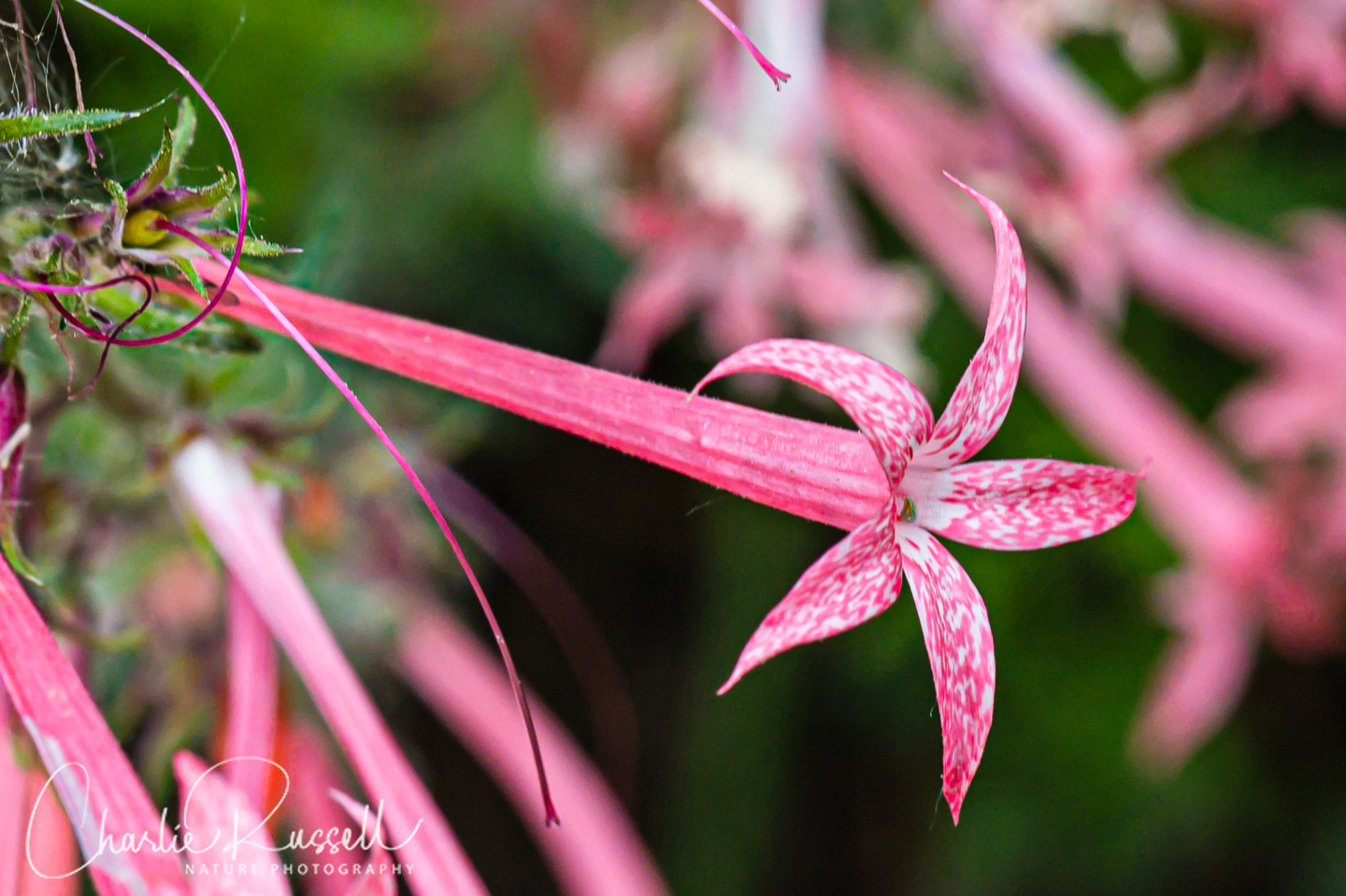
- Fireweed, Chamerion angustifolium ssp. circumvagum
- Fringed willowherb, Epilobium ciliatum
- Goldenbush, Ericameria sp.
- Gray’s lovage, Ligusticum grayi
- Hoary aster, Dieteria canescens var. canescens
- Leichtlin’s mariposa lily, Calochortus leichtlinii
- Lemon sagewort, Artemisia michauxiana
- Lewis’ flax, Linum lewisii var. lewisii
- Little elephant’s head, Pedicularis attollens
- Meadow lupine, Lupinus polyphyllus var. burkei
- Mertens’ rush, Juncus mertensianus
- Mountain alder, Alnus incana ssp. tenuifolia
- Mountain carpet clover, Trifolium monanthum
- Naked buckwheat, Eriogonum nudum
- Narrow tube ipomopsis, Ipomopsis tenuituba
- Nettleleaf giant hyssop (aka Horse mint), Agastache urticifolia
- Naked buckwheat, Eriogonum nudum
- Oregon sunshine, Eriophyllum lanatum var. integrifolium
- Owl’s claws, Hymenoxys hoopesii
- Pacific red elderberry, Sambucus racemosa var. racemosa
- Pale mountain coyote mint, Monardella odoratissima ssp. pallida
- Panicled willow herb, Epilobium brachycarpum
- Primrose monkeyflower, Erythranthe primuloides
- Rocky mountain groundsel, Packera streptanthifolia var. streptanthifolia
- Roundleaf snowberry, Symphoricarpos rotundifolius
- Rosy pussytoes, Antennaria rose
- Scarlet paintbrush, Castilleja miniata ssp. miniata
- Shasta clover (aka Productive clover), Trifolium productum
- Sierra bog orchid, Platanthera dilatata var. leucostachys
- Sierra larkspur, Delphinium glaucum
- Sierran woodbeauty, Drymocallis lactea var. lactea
- Silvery lupine, Lupinus argenteus var. heteranthus
- Slender cinquefoil, Potentilla gracilis
- Sparse flowered bog orchid, Platanthera sparsiflora
- Spearleaf arnica, Arnica longifolia
- Spearleaf stonecrop, Sedum lanceolatum
- Sticky cinquefoil, Drymocallis glandulosa
- Sulphur buckwheat, Eriogonum umbellatum
- Swamp onion (Pacific onion), Allium validum
- Tiling’s monkeyflower, Erythranthe tilingii
- Wandering fleabane, Erigeron glacialis var. glacialis
- Wavy leaf paintbrush, Castilleja applegatei ssp. pallida
- Western columbine, Aquilegia formosa
- Western polemonium (aka Western sky pilot), Polemonium occidentale
- Whitebark pine, Pinus albicaulis
- Willow, Salix sp. (nif)
- Woolly mule ears, Wyethia mollis
We also found the following:
- Lady beetle larva, Family Coccinellidae (Lady Beetles), Subfamily Scymninae. Mealy Bug destroyer?
- Bee Fly, Bombyliidae family


Add comment