


Sardine Falls is an easy to reach waterfall just off of Highway 108 near Sonora Pass. We visited in early September 2023, and while the creek was still flowing, the flowers were well past prime.
On the other hand, it is wonderful to find ANY wildflowers still in bloom in September, so we enjoyed this hike very much!
Given how late in the season it was, there weren’t any crowds, and the creek was easy to cross. Earlier in the season you may get wet feet, but there should be abundant wildflowers.
The Flowers
Here’s a sample of a few of my favorites from this hike (click on the image to see a larger view).
This was an interesting find. I’m not showing the diagnostic photos here, but this worked out to be Tall agoseris, Agoseris x elata. It is a hybrid of several Agoseris species (hence the “x” in the scientific name). One botanical reference refers to this as “an enigmatic taxon”, as it has a collection of features that don’t match any other particular species. The flower looks like Agoseris aurantiaca, but when you get down to details like the hairs on the bracts and leaves, this one doesn’t match. My thanks to Steve and Shellie Perry who helped me with the ID.
Tall agoseris
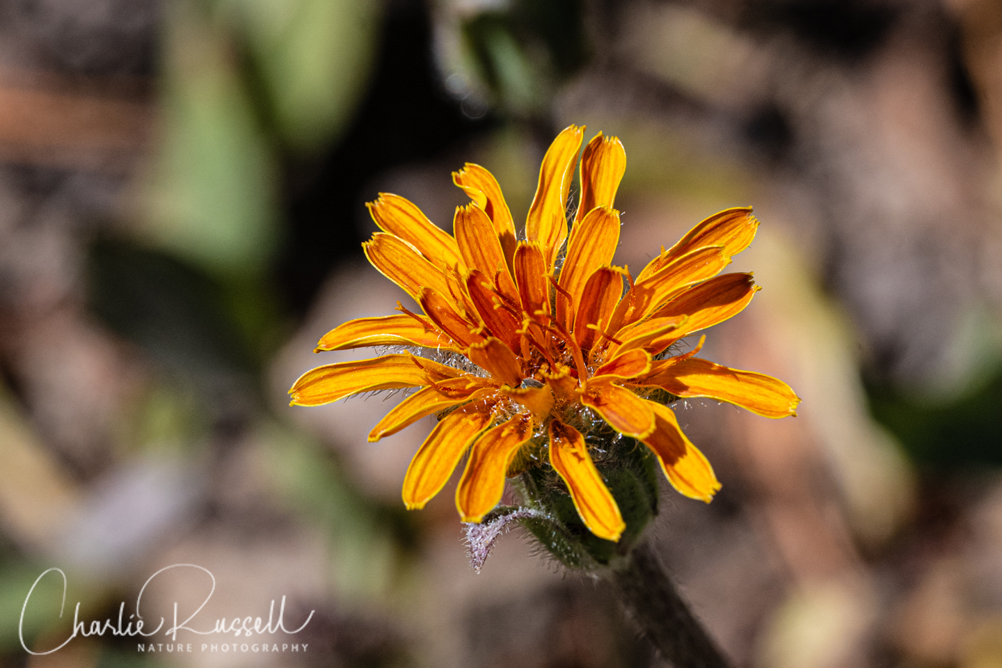
I’ve come across this one several times in the Sonora Pass area. It stands out, a big bright yellow composite flower. Owl’s claws.
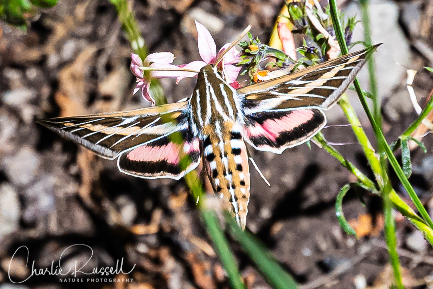
2023 was a very wet year, and in some ways the highlight of the year was finding SO MANY White-lined Sphinx moths in so many places over the season. Low altitude near the coast, high altitude in the Sierras, down in the Central Valley near Davis and Fresno, so many of them. We found several on this hike, near the waterfall, feeding on Slendertube skyrocket. This moth is a specialist in semi-arid environments, so it’s very responsive to high rainfall years. They are big – at least 3″ across, and they move VERY fast. I had to use a fast shutter speed to catch the wings, which normally are just a blur.
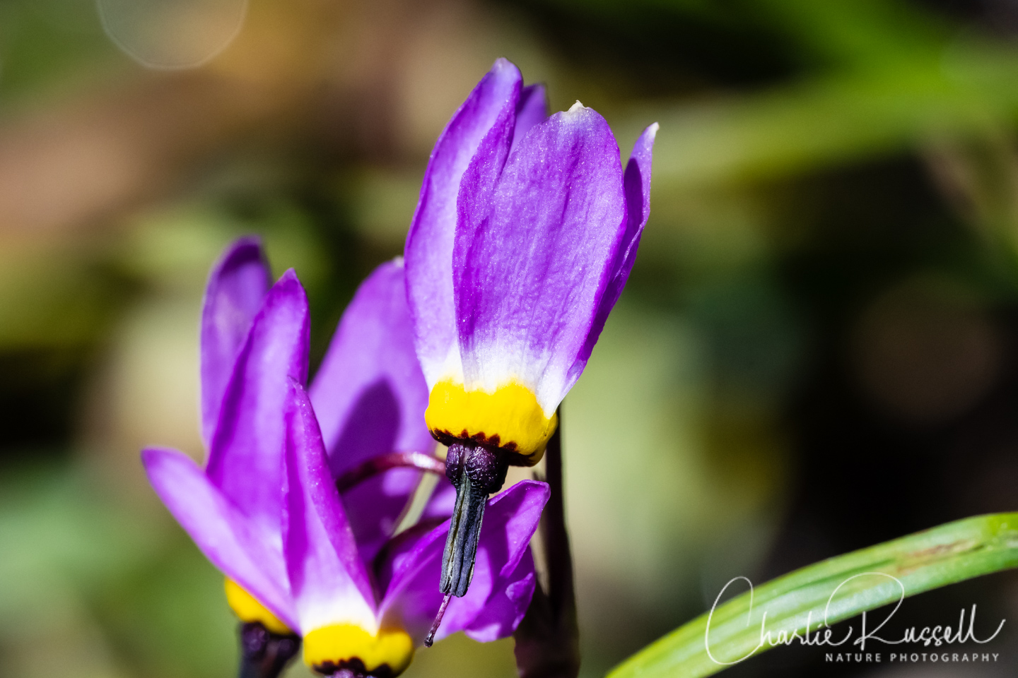
It was a pleasant surprise to find a few Alpine shooting stars hanging in there at the end of the season. Usually they would be long gone by now.
Here’s a gallery of the most interesting finds (flowers and insects). A short list. Since it was so late in the season, lots of the flowers were ragged, so the pictures weren’t great. Plus, I was trying out a new camera, and I didn’t have all the settings worked out the way I wanted.
For the best viewing experience, click on the lightbox image below, and you can scroll through larger versions of the photos of many of the plants (and other things) that we found on this hike. All photos are available for purchase in a variety of formats.


The Hike
This is an easy hike as long as you can find the trail. My track shows 2.8 miles out and back, but I was wandering off trail quite a bit. The starting elevation was 8725′, and the foot of the falls was about 9088′. This late in the season, we only ran into one other couple on the trail. It was very peaceful!
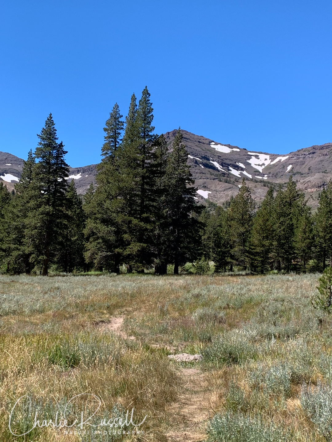
You start across an open sagebrush meadow. There was a 4WD track there, for part of the way, mostly overgrown.
You have to cross Sardine Creek, which runs parallel to the highway. On this visit we were able to hop across – earlier in the year you may have a wet crossing.
Most of the wildflowers in this section were found close to the stream.
The trail joins up with McKay Creek, which runs up into the hills, to the falls.
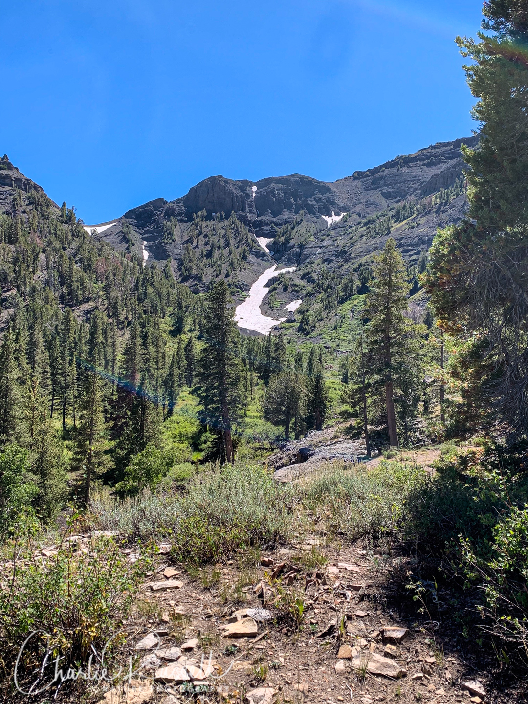
After the meadow the trail is less obvious, just keep the creek to your left (the trail wanders away from the creek a bit). You’ll climb up into the trees and low shrubs. Most of the flowers, on this visit, were in the shady sections not far from the creek.
We could still see snow on the hills higher up.
Not far from the falls you will cross a branch of the creek. Again, easy to cross this time, but it might be a bit wet earlier in the year.
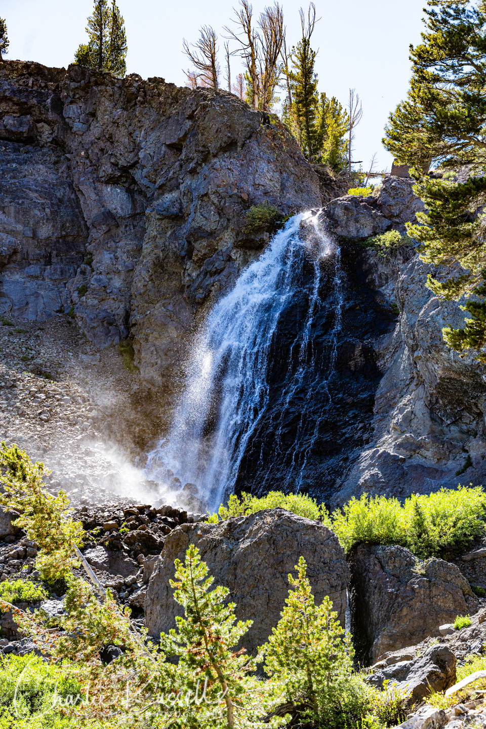
The falls are roughly 70′ high, coming through a cleft in the hill. There is a smaller cascade coming through a crack in the rocks, which you can see at the lower right. We didn’t try to climb up to the top of the falls – there wasn’t an obvious trail up and the water spray made things very slippery
Here’s the track that we followed:
Sardine Falls
Profile
Move your mouse along the elevation graph to show the location on the map. The Refresh icon will re-center the map. The Expand icon will expand to full screen.
Directions
The parking area for the Sardine Falls trailhead is about 2.5 miles east of the Sonora Pass sign (and Pacific Crest Trail Sonora Pass Trailhead) on Highway 108. That puts it about 68 miles east of the town of Sonora. Aim for a GPS location of 38.314472, -119.605917. It is just a wide spot along the road, and there wasn’t a sign for it on our visit. When we visited, Google Maps had the location a quarter mile too far east, where there wasn’t a trail, but I think I’ve been able to correct that. The trail heads off across the meadow to the south of the road. It isn’t a maintained trail, but the path was fairly obvious. Just keep heading southwest along the creek that comes down from the hills.
Timing is Everything
This hike was in September, pretty late in the hiking season. Given how wet this year was, it isn’t surprising that there was a lot of water in McKay Creek, so the waterfall was great! There was snow on the mountains behind the falls. Sardine Creek, the first big crossing, was easy to get across without getting damp shoes. However, I think that when the flowers are at their peak you may find it more difficult to cross the stream without getting wet. In the meadow just after the parking area we could see areas where the water had been quite high.
Sardine Falls Wildflowers
Here’s a listing of the native plants that we found on this visit.
In most cases the scientific name will be a link to a reference source such as Calflora.
- Alpine shooting star, Primula tetrandra
- American bistort, Bistorta bistortoides
- Anderson’s thistle, Cirsium andersonii
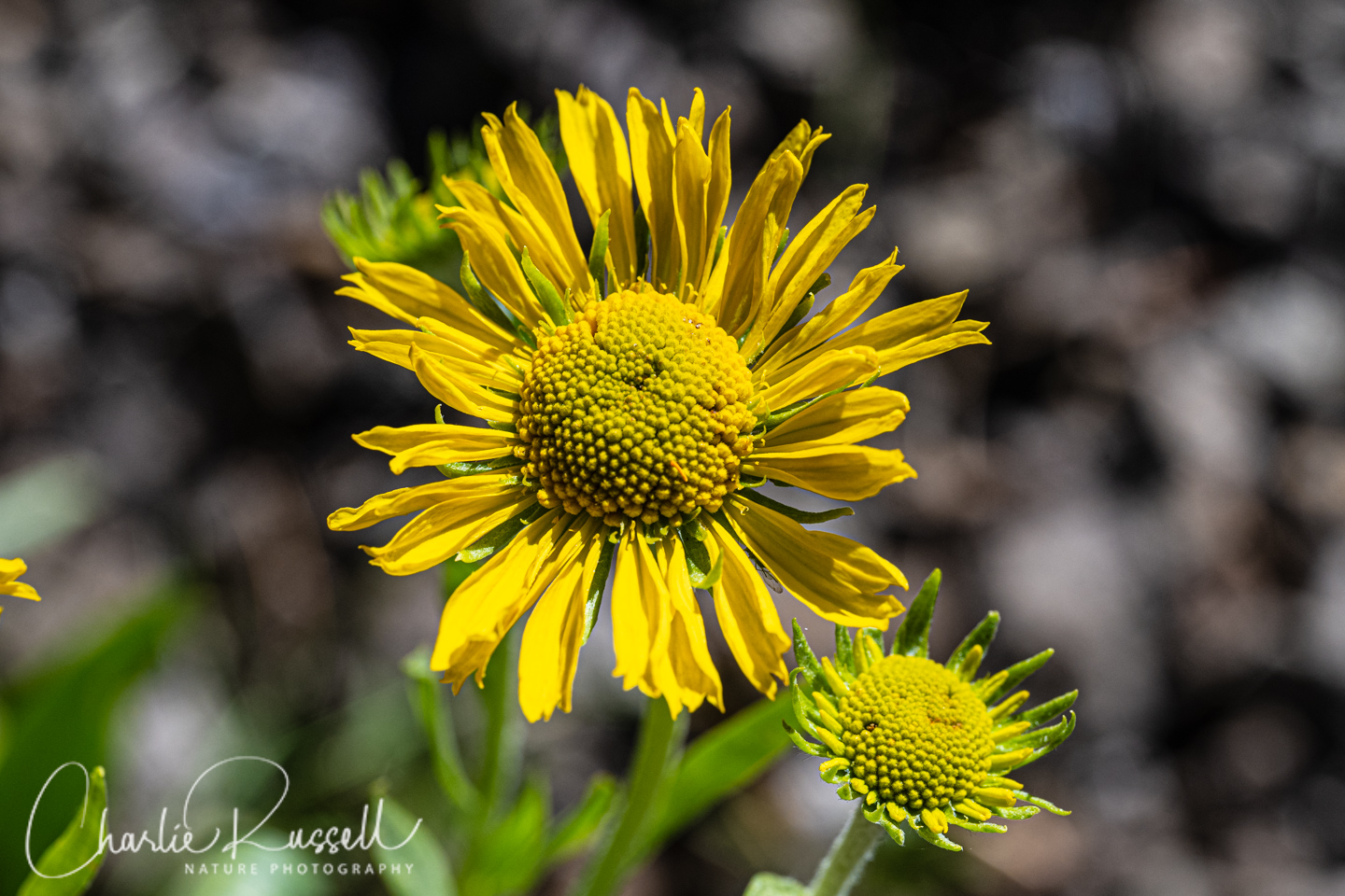
- Arnica sp.
- Arrowleaf ragwort, Senecio triangularis
- Big sagebrush, Artemisia tridentata
- Bloomer’s goldenbush, Ericameria bloomeri
- Bolander’s silver sagebrush, Artemisia cana ssp. bolander
- California wavewing, Cymopterus terebinthinus var. californicus
- Columbian monkshood, Aconitum columbianum ssp. columbianum
- Common Yarrow, Achillea millefolium
- Coulter’s fleabane, Erigeron coulteri
- Diffuse groundsmoke, Gayophytum diffusum
- Fireweed, Chamerion angustifolium ssp. circumvagum
- Goldie’s starwort, Stellaria longipes ssp. longipes
- Lake tahoe lupine, Lupinus argenteus var. meionanthus
- Leichtlin’s mariposa lily, Calochortus leichtlinii
- Lobb’s dwarf lupine, Lupinus lepidus var. lobbii
- Meadow lupine, Lupinus polyphyllus var. burkei
- Mountain coyote mint, Monardella odoratissima ssp. glauca
- One seeded pussypaws, Calyptridium monospermum
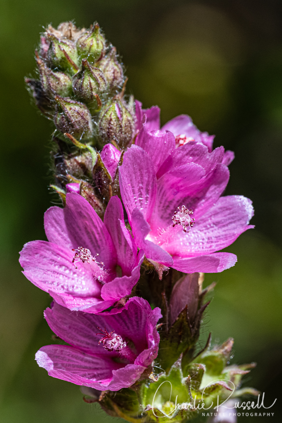
- Oregon checkerbloom, Sidalcea oregana ssp. spicata
- Owl’s claws, Hymenoxys hoopesii
- Ranger’s buttons, Angelica capitellata
- Rockcress, Boechera sp.
- Rocky mountain groundsel, Packera streptanthifolia var. streptanthifolia
- Scarlet gilia, Ipomopsis aggregata ssp. aggregata
- Scarlet paintbrush, Castilleja miniata ssp. miniata
- Shortray fleabane, Erigeron lonchophyllus
- Sierra beardtongue, Penstemon heterodoxus var. heterodoxus
- Sierra larkspur, Delphinium glaucum
- Sierran woodbeauty, Drymocallis lactea var. lactea
- Slender cinquefoil (aka Nuttall’s cinquefoil), Potentilla gracilis var. fastigiata
- Slendertube skyrocket, Ipomopsis tenuituba
- Squirreltail, Elymus elymoides
- Sulphur buckwheat, Eriogonum umbellatum
- Tall agoseris, Agoseris ×elata
- Thickstem aster, Eurybia integrifolia
- Tiling’s monkeyflower, Erythranthe tilingii
- winberry honeysuckle, Lonicera involucrata var. involucrata (in fruit)
- Western columbine, Aquilegia formosa
- Western prickly gooseberry, Ribes montigenum (in fruit)
- Whiskerbrush, Leptosiphon ciliatus
- Woolly mule ears, Wyethia mollis
- Yampah, Perideridia sp.
We also found the following:
- Black-footed drone fly, Eristalis hirta
- Nearctic bumble bee, Bombus vancouverensis ssp. nearcticus
- Sheepmoth, Hemileuca sp. (caterpillar)
- Thick-headed fly, Thecophora sp. These are frequently found on flowers. They are endoparasites of other insects, specially bees.
- White-lined sphinx moth, Hyles lineata


Add comment