


The Martis Creek Wildlife Area has a surprising variety of native wildflowers early in the season. This is an easy trail near the Truckee airport.
When you look out over the area you think it is just dry sagebrush scrub, but if you get a chance to hike this trail at the right time you will find a lot to keep your interest!
The Flowers
Here’s a sample of a few of my favorites from this hike (click on the image to see a larger view).
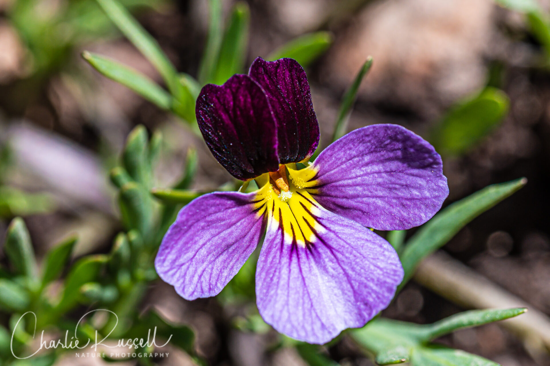
The star of the day was Beckwith’s violet. I don’t usually find this because it is an early season native wildflower found at higher altitudes, and usually at this time I’m exploring places at lower elevations. I was hoping to find a few on this hike, instead we found hundreds of them along several portions of the trail!
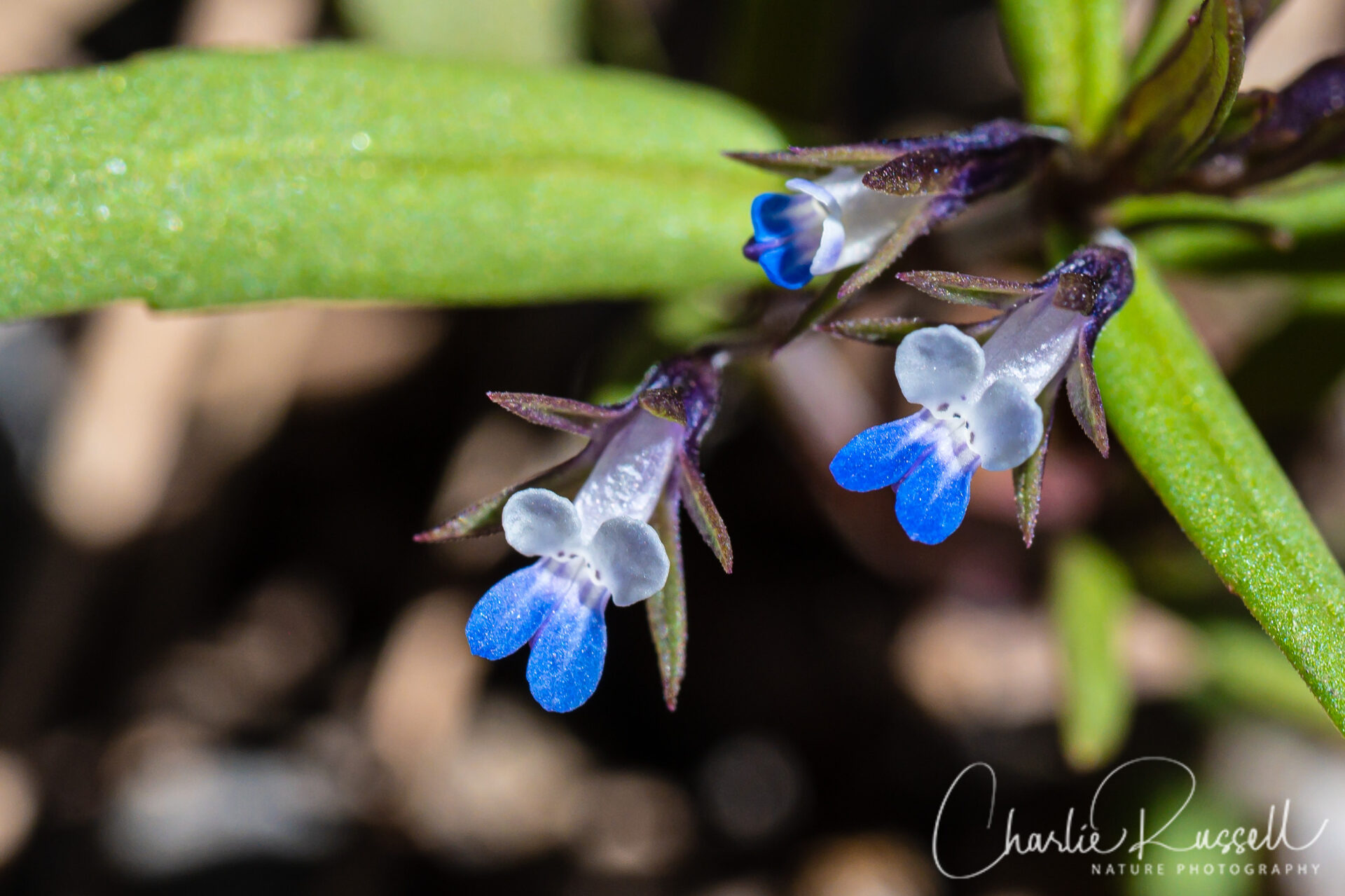
I love to find what I call “microflowers” – those little wildflowers that many people miss because they are so tiny (aka “belly flowers”). The blossoms of small flowered blue eyed mary are just 5 mm across, but they are beautiful when you get a close look at them. We found these before we even got out of the parking area, as well as at many spots on the trail.
Another interesting plant is alpine breeches. Hiking along, you see this lump of green leaves, and you may just pass it by.
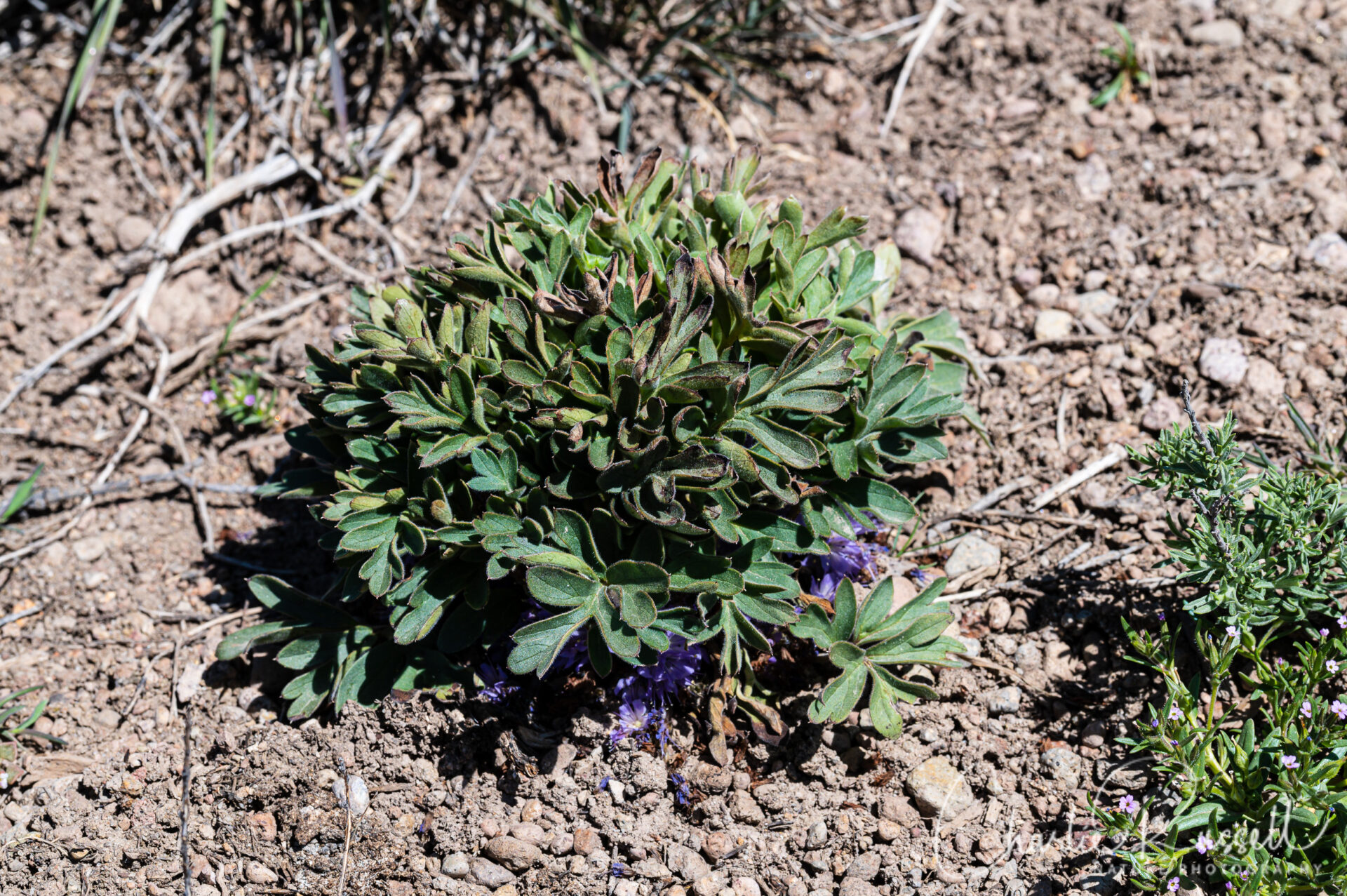
But if you peek under the edges, you find a beautiful array of blossoms!
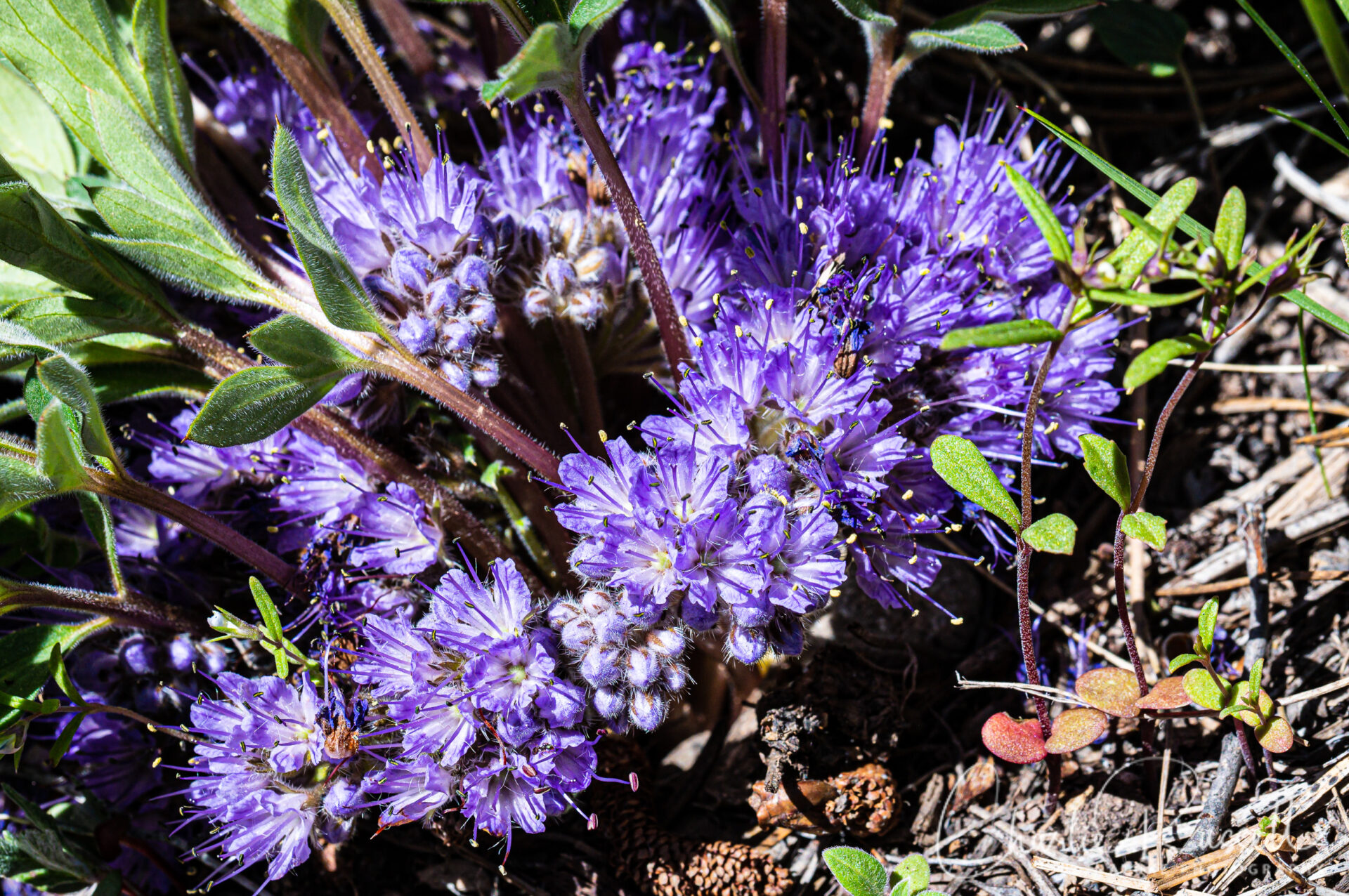
If you click on the lightbox image below you will see larger versions of the photos, and you can scroll through all of the plants (and other things) that we found on this hike. All photos are available for purchase in a variety of formats.


")


The Hike
This is an easy 4.5 mile (roughly) loop hike that is relatively flat.
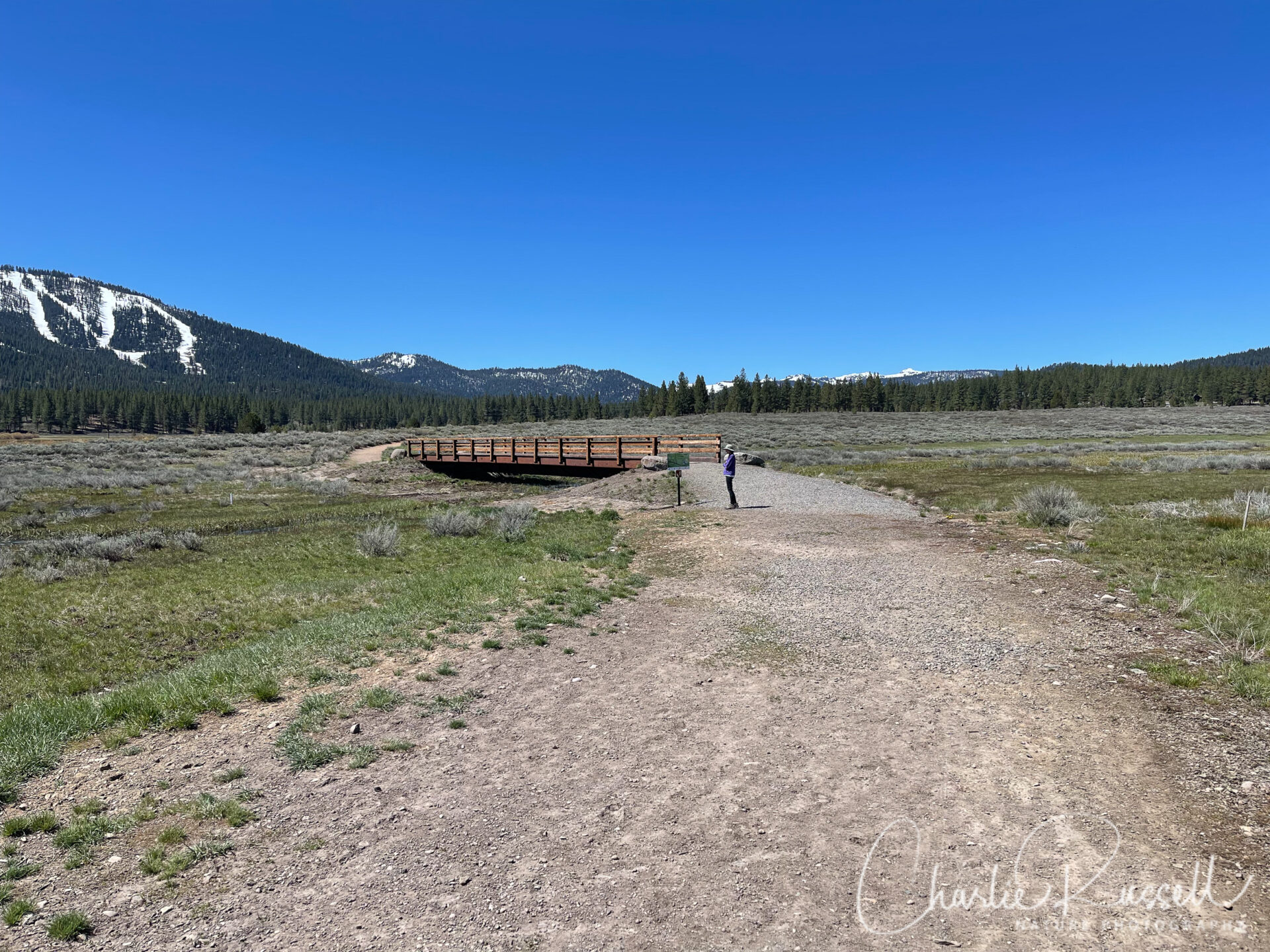
From the parking lot you will head south on a gravel trail, towards a bridge. There may be some “no trail access” signs on either side, which is confusing, but those apply to the roads that run parallel to the highway. You can continue straight towards the footbridge with no trouble.
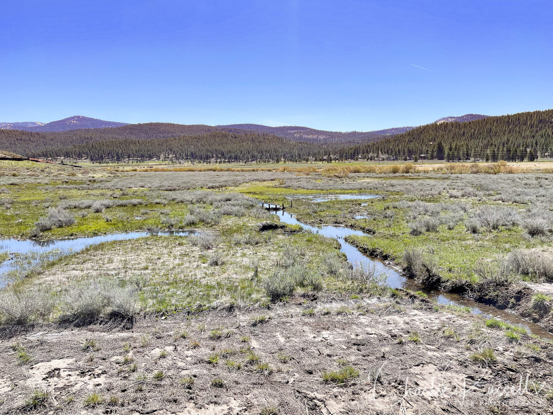
Stay on the trail! You are crossing a wet meadow with sensitive habitat. The trail has multiple bridges that cross the meandering streams.
Fortunately, there is an abundance of interesting wildflowers all along the sides of the trail, easily accessible.
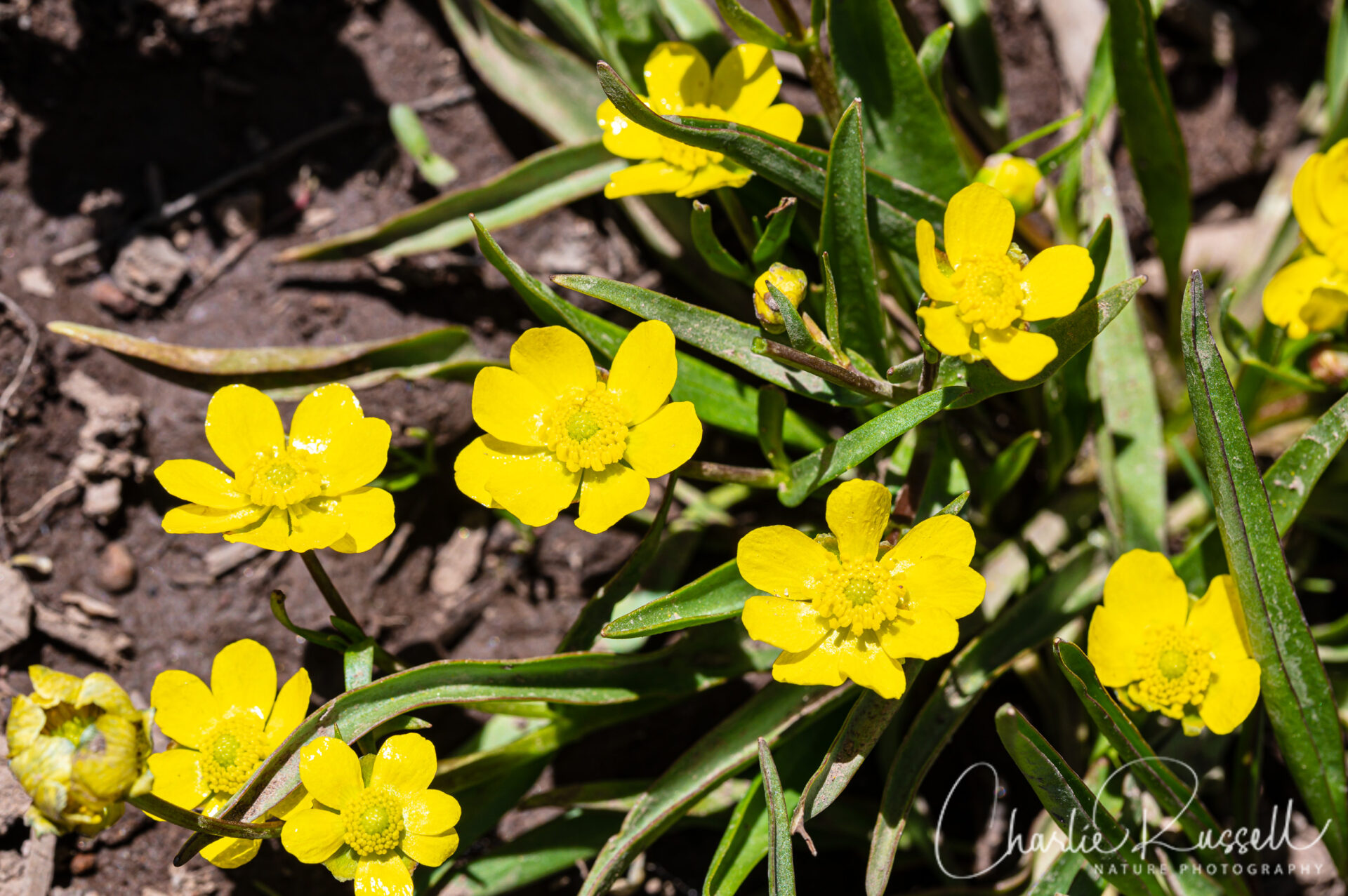
The broad gravel trail will head into some trees and then come out into another portion of the meadow that is covered in grass. Stay on the wooden walkway as it crosses the meadow and stream. This area is moister, and we found a different collection of wildflowers here. Lots of Beckwith’s violets, plantainleaf buttercups, and more. From this point on the trail is a narrower dirt track, it could be muddy in spots.
The trail turns in to the forest, to get to a bridge that crosses the creek. Views of the ski runs in the distance.
Note that there are benches at several places along the way, and there is a picnic table near the creek in the trees. It is very pleasant. We found a different collection of wildflowers along this section.

The trail skirts along some very expensive looking condominiums, and eventually comes to a golf course. The trail skirts along the edge of the golf course.
The trail returns to the meadow, with even more violets and buttercups. It is worth going this far, as you may find some flowers you haven’t seen yet on this hike (we found several species).
PLEASE NOTE that the trail and parking are being reconfigured, so you might find that access has changed since the time I visited.
Here’s the track that we followed:
Martis Creek
Profile
Move your mouse along the elevation graph to show the location on the map. The Refresh icon will re-center the map. The Expand icon will expand to full screen.
Directions
The Martis Creek Wildlife Area is near the Truckee Airport. From Highway 80 take exit 188 onto Highway 267 towards Lake Tahoe. About 3.5 miles from 80 you will see a small sign for the Martis Creek Wildlife Area, and a parking lot.
Note that the parking lot is small (only room for about 20 cars), and this is a popular spot for dog walking and mountain biking. It is easier to park here mid day, after the morning dog walking rush is over.
There are no restroom facilities here. However, just across the highway is the entrance to the Martis Creek Lake Recreation Area, and there are pit toilets easily accessible there.
Timing is Everything
Timing is the big issue here. We visited in the first week of May 2022, and it was a clear sunny day with very little wind. Temperatures were in the low 70’s, which was amazing.
However, just a couple of days after this hike, the weather changed, and three inches of snow fell in the area. I’m not sure what that did to the flowers!
We’ve hiked in this general area before, at Waddle Ranch (just across the highway), in June, and found it very hot and dry.
So I’m not sure what to say other than to try it in May, but check the weather forecast!
Martis Creek Wildlife Area Wildflower Listing
Here’s a listing of the native plants that we found on this visit.
The scientific name will usually be a link to a reference source such as Calflora. “nif” means “not in flower”.
- Alpine breeches, Hydrophyllum alpestre
- Antelope bitterbrush, Purshia tridentata var. tridentata (nif)
- Beckwith’s violet, Viola beckwithii
- Big sagebrush, Artemisia tridentata (nif)
- Brown’s peony, Paeonia brownii (nif)
- Columbia ragwort, Senecio integerrimus var. exaltatus
- Goosefoot violet, Viola purpurea
- Greenleaf manzanita, Arctostaphylos patula
- Hooker’s balsam root, Balsamorhiza hookeri
- Bulbous woodland star, Lithophragma glabrum
- Mahala Mat, Ceanothus prostratus (nif)
- Meadow deathcamas, Toxicoscordion venenosum var. venenosum (nif)
- Narrow-leaved montia, Montia linearis
- Nevada biscuitroot, Lomatium nevadense
- Northern sanicle, Sanicula graveolens
- One seeded pussypaws, Calyptridium monospermum
- Pursh’s milk vetch, Astragalus purshii var. tinctus
- Redstem springbeauty, Claytonia rubra ssp. rubra
- Slender phlox, Microsteris gracilis
- Small flowered blue eyed mary, Collinsia parviflora
- Virginia strawberry, Fragaria virginiana (nif)
- Western buttercup, Ranunculus occidentalis
- Willow, Salix sp.
The following are non-native plants that we found on the hike as well:
- Bull thistle, Cirsium vulgare (nif)
- Common dandelion, Taraxacum officinale
We also found the following:
- Brown-eyed Wolf Lichen, Letharia columbiana
- Sponge Gall Midge, Rhopalomyia pomum (on Artemisia tridentata)
- Thrip


Add comment