


There are a number of hikes that start from Lucas Valley Road in Marin County. This hike starts at the Big Rock trailhead and heads up into the hills, towards the Loma Alta Open Space Preserve and back. Not a lot of wildflowers, but a wonderful (and energetic) hike.
There are several open space preserves in this area, with well maintained trails. In addition, the Bay Area Ridge Trail connects many of the preserves and parks in the San Francisco Bay Area by acquiring trail rights of way through private lands. On this hike we started at the Big Rock trailhead on Lucas Valley Road and hiked through the hills on one of these connecting trails, reaching the Loma Alta Open Space Preserve and looping back. This was in late February 2018, and it was a bit early for a good show of wildflowers. However, the weather was wonderful (albeit a bit cool) and it was wonderful to get out into the hills where you couldn’t hear any sounds other than the birds and the howling of a lone coyote (and the bellowing of cows, sometimes).
The Hike
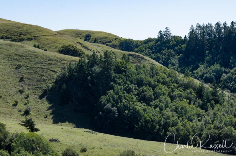
We started at the Big Rock trailhead on Lucas Valley road. There are two trails that start at this trailhead – a trail to the north (the side that Big Rock is on) that goes up into the Lucas Valley Preserve, and a fire road on the south side that goes straight up the mountain. The hike we took this time was on the fire road. This is an energetic hike, since fire roads tend to just go straight up the hill, rather than having switchbacks.
For wildflowers, make sure you look off to the west side of the trailhead, right at the start. On the side of the hill we found the best collection of wildflowers, with a large mass of Yellow carpet, with some Red maids and Yellow owls clover mixed in.
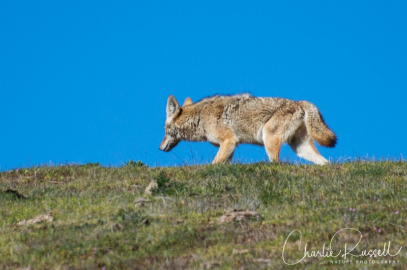
When I hike, I’m always looking at the ground for wildflowers. I have to remember to look up every once in awhile. If I hadn’t, I might have missed this coyote on the hillside above us!
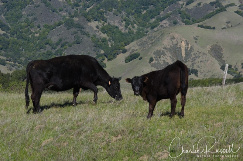
This trail passes through private property, so you don’t want to wander off the trail. A little over a mile into the hike you will pass through a cattle gate. It is very evident that these hillsides are grazed by cattle. For the most part, they just ignore you, but you don’t want to approach them too closely. We also passed by a herd of goats on one hillside.
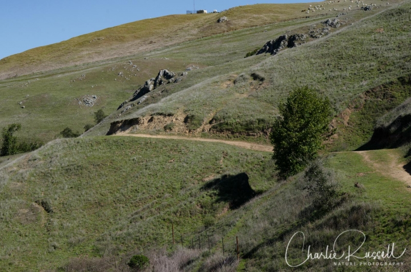
About 1.5 miles into the hike the trail splits. The main fire road continues straight up the hill, which is the direction we took. There is a trail sign here, but it isn’t obvious that it is a split. The trail goes up to the peak, then loops around the back side of the mountain, where you will find a junction with the trail that heads into the Loma Alta Open Space Preserve. The trail we took continues to the right, and eventually rejoins the fire road that came up the hill.
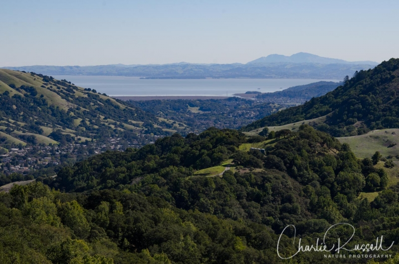
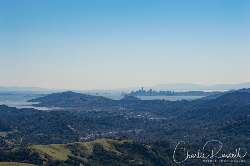
The majority of the trail is very exposed on the hillside, without any shade. There are a few trees on the back side of the mountain. There are some wonderful vistas, sometimes towards Mt Tamalpais, sometimes towards the north end of the San Francisco Bay, and even a nice view of San Francisco.
This loop is 5.6 miles, with an elevation gain of 1125 feet. Here’s the track that we followed:
Big Rock Loop
Profile
Click on the track to see an elevation graph. Move your mouse along the elevation graph to show the location on the map. The Refresh icon will re-center the map.
Preserve Maps:
Directions
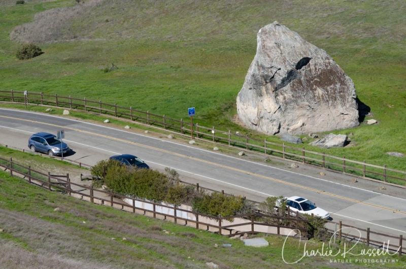
The Big Rock trailhead is on Lucas Valley Road in Marin County. Take the Lucas Valley Rd / Smith Ranch Rd exit from highway 101 and go west on Lucas Valley Road. The trailhead is 5.3 miles from the highway. You can’t miss the “big rock”. Parking is very limited along the roadside, you can only park on the south side of the road. The trail we took is through the gate in the fire road that heads south from the parking area.
Timing is Everything
We hiked here in February, and the wildflowers were just starting. It should be very pleasant later in the spring. In the summer it might get hot, as there is no shade on the trail at all. I wouldn’t hike here after a period of rain, the trail would be very muddy. Another consideration is the time of the week – I’m told that on weekends this is a very popular trail for mountain bikers and equestrians, so it might be a bit crowded. We hiked on a Friday, and we only encountered a few hikers.
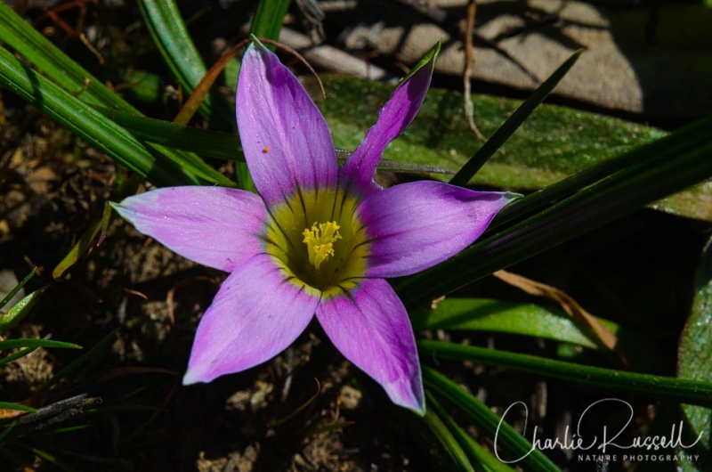
Another aspect to consider is the time of day. We started on this mid-morning, and returned mid-afternoon. On the way back we saw a lot more flowers than on the way up, because many of them weren’t open until the afternoon. Rosy Sandcrocus are tucked down in the grass and weren’t visible until things warmed up. We didn’t see any in the morning, but on the way back they were all over the place.
Lucas Valley Wildflowers
There is a real mix of native and non-native plants on this hike.
Yellow carpet is an early season wildflower. It is an unusual flower in that it has white pollen.

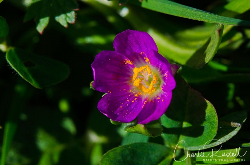
Red maids can be found all over Northern California, but I’m always happy to find them because they have such bright colors. They really stand out even though they are so small. This is another flower that opens up later in the day, so you might miss them in the morning. Lots of pollen in this one!
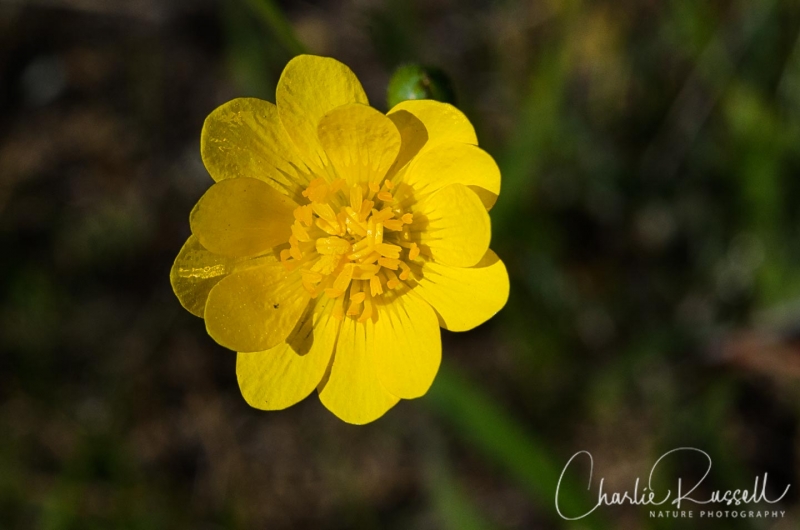
California buttercup was probably the most common flower on this hike.
If you click on any of the photos below you will be able to scroll through larger versions of the pictures. All photos are available for purchase in a variety of formats.


")


Here’s a listing of what I found on this visit:
- Brownie thistle (Cirsium quercetorum)
- California buttercup (Ranunculus californicus)
- California man-root (Marah fabacea)
- California poppy (Eschscholzia californica)
- Hog fennel (Lomatium dasycarpum)
- Milk maids (Cardamine californica)
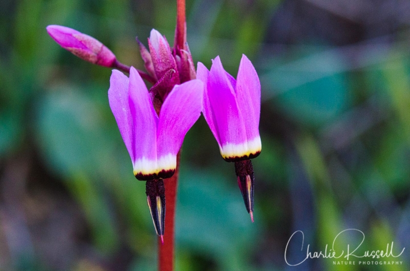
- Mosquito bill (Primula hendersonii)
- Red maids (Calandrinia menziesii)
- Yellow carpet (Blennosperma nanum var. nanum)
- Yellow owl’s clover (Castilleja campestris)
The following are non-native plants that we found on the hike as well:
- Longbeak stork’s bill (Erodium botrys)
- Red stemmed filaree (Erodium cicutarium)
- Rosy sandcrocus (Romulea rosea)
- Scarlet pimpernel (Lysimachia arvensis)


Add comment