


The King Mountain Open Space Preserve is a fun, accessible hike in Marin County that is a part of a cluster of interconnected parks and preserves with a wide variety of trails. The main trail is a loop around the top of the mountain where you cross through exposed hillsides as well as shaded paths. You’ll also find some nice views of the Mt. Tamalpais and the San Francisco Bay. You may not see huge expanses of wildflowers, but there is a great variety. It’s easy to combine this with the Ring Mountain hike in nearby Tiburon.
Click on any photograph to see a larger image.
The Hike
This is an easy to moderate hike. It is fairly flat most of the way, but there are some sections where it is a bit steep (not for long) as well as one long series of steps. For most of the hike you are in the shade of the trees, with occasional breaks for a view of Mount Tamalpais or the San Francisco Bay.
From the trailhead we started at (see the directions below) we took the path to the right, down the hill. This portion of the trail is a bit steep and is somewhat rutted and eroded. Watch for poison oak. This wouldn’t be a great section to try just after a heavy rain. We did see a lot of Hounds tongue along this section. There are a number of trails that intersect, keep taking the left hand trail (the obvious trail, not one of the small unofficial trails heading off into the hillside).

This leads to a fairly flat section of chaparral where you can see views of Mt. Tamalpais. We found a variety of small flowers along this section, different than what you’ll see in later sections.
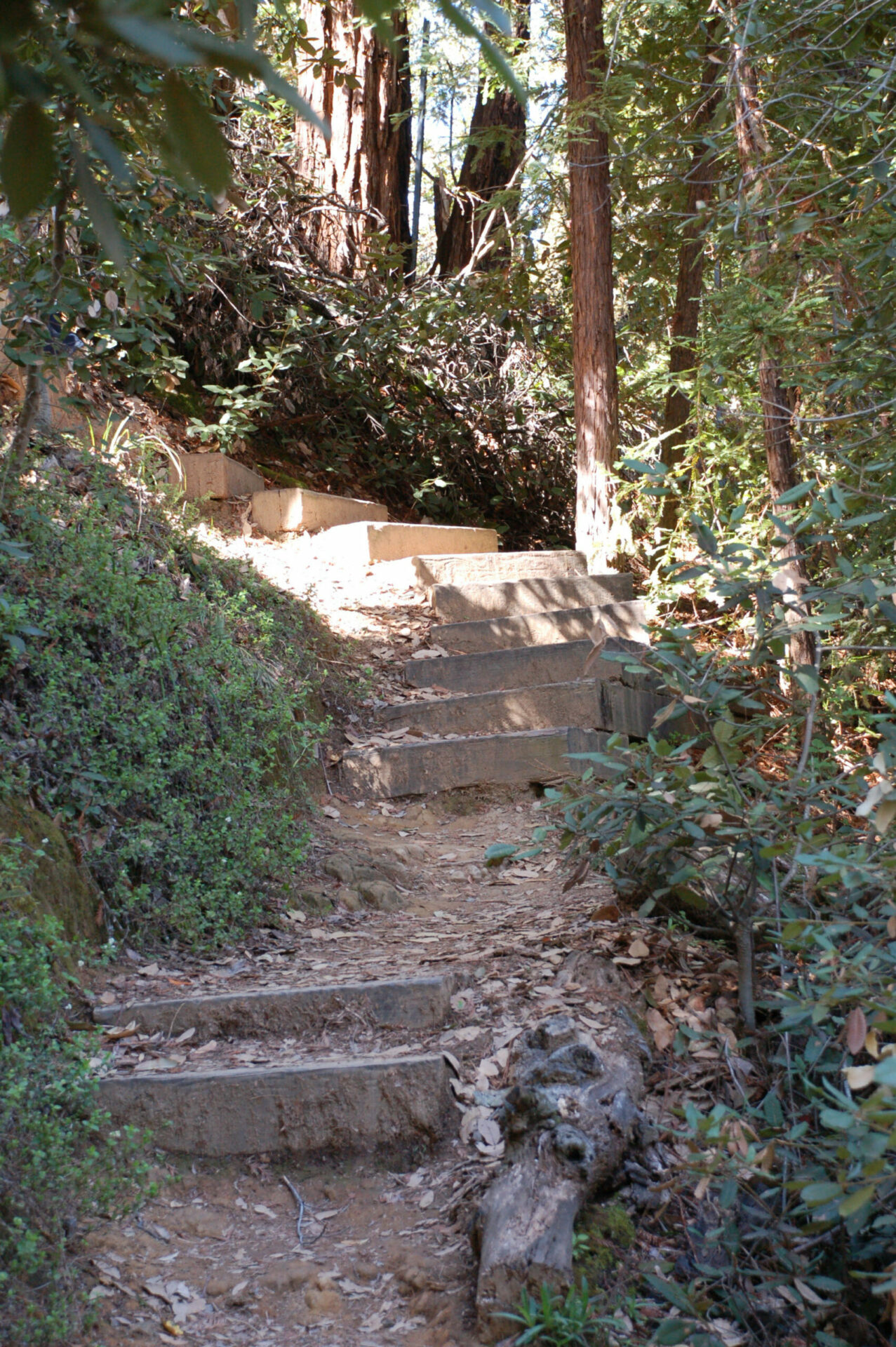
Keep in mind that you always want to bear left, circling around the mountain. Further along the trail you come to a wooded, cool section that winds through tanoak, and California bay trees, and eventually a small number of redwood trees. Keep your eyes open, there are many different flowers scattered along the trailside. This section also has a fair number of well maintained steps climbing up the hill.
You’ll eventually loop all the way around the mountaintop and come back to your starting point.
This is a popular trail, so you could see a lot of people. Most of the trail is for hikers only, but some sections may be open to mountain bikers. We saw some very large groups of people, as well as several people running on the loop.
In the early spring you’ll see lots of Scotch Broom, an invasive plant that crowds out other plants and destroys wildlife habitat. While it is very pretty when it is blooming (lots of bright yellow flowers) it isn’t something that I’m happy to find. I know that in many of the Preserves in Marin there are programs in place to try to eradicate this.
My guess is that this loop is about 2.5 miles, roughly, if you use the access point that we started from. There is another access point lower on the mountain, that can add another mile or less.
For a detailed map of the Preserve see the Marin County Parks map for King Mountain.
Timing is Everything
We hiked in early March of 2012, which was a relatively dry year. The trail was nice and dry, and there was an nice selection of flowers. If we had come earlier we would have seen the Fetid Adder’s Tongue blooming, which is actually more attractive than it sounds. Given that this is so nicely shaded I think that you’ll find flowers any time in the spring. There were signs of a number of flowers that would be blooming later. Even without flowers, it would be an enjoyable hike!
Directions
There are several access points to this Preserve. The one that we took was:
- From Highway 101 in Larkspur (Marin County) take the Sir Francis Drake Blvd exit west towards Fairfax.
- Turn left at College Avenue, in Kentfield.
- Turn right at Woodland Road, just past a shopping center. This is an odd corner, with Kent Avenue coming in at an angle.
- Turn left at Evergreen Drive, not too far along Woodland Road. This is a fairly steep climb up the mountain through a beautiful residential area. The road twists quite a bit.
- Turn left at Ridgecrest Drive. Pay careful attention to the street signs, as you will pass Ridgewood drive before you get to Ridgecrest drive. If you end up at a cul-de-sac with no trailhead and just a steep hillside going up (and driveways), you took the wrong one (as we did on our first try).
At the very end of Ridgecrest there is a fire road. Park here, there is a wide shoulder with a few parking spaces. Not many, though! Be careful to not block driveways or access to the fire road. There are no restrooms here. A short walk in on the fire road brings you to the trail. You can choose either direction – if you go right you clamber down the rutted portion of the trail, then later go up the stairs. If you go left, you get the stairs downhill but then have the rutted portion going up.
You can also hike in to the King Mountain loop trail on the Ladybug Trail, which connects to the Dawn Falls Trail from the adjacent Baltimore Canyon Open Space Preserve and Blithedale Summit Open Space Preserve.
The Flowers
Please feel free to correct any errors I may make. Click on any photograph to see a larger image. I’ll start with a few favorites, and then the “gallery”. All pictures were taken with a Nikkor 18-135mm zoom lens, or a Nikkor 60mm closeup lens.
Yes a number of these are common weeds, but I enjoyed seeing these early season flowers.
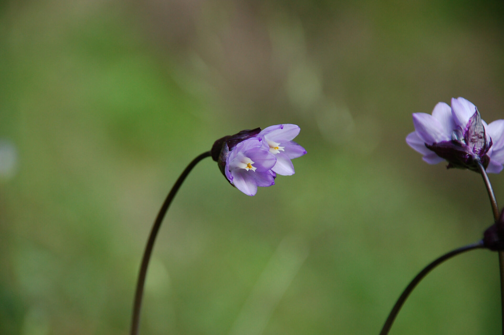
Hound’s Tongue is named for the shape ad texture of the leaves. These were plentiful on the earlier (drier) part of our trip.
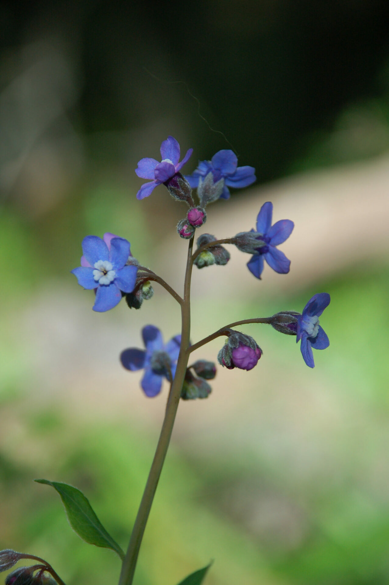
Fremont’s Star Lily is also known as Fremont’s Death Camas. These also were found on the early part of the trail. This was the first time I’ve seen this flower, and there were quite a few.

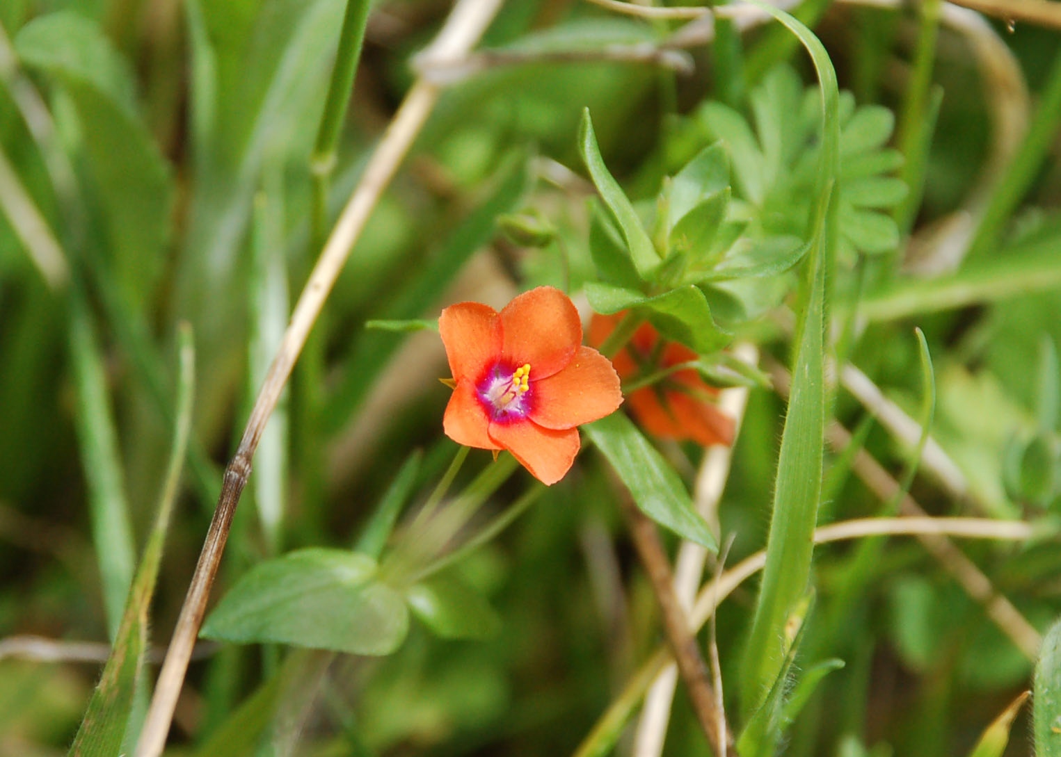
OK, Scarlet Pimpernel is a weed. Slightly toxic. I still enjoy finding them and they are very bright. You have to look closely to see all the colors, as these are less than a quarter-inch across.
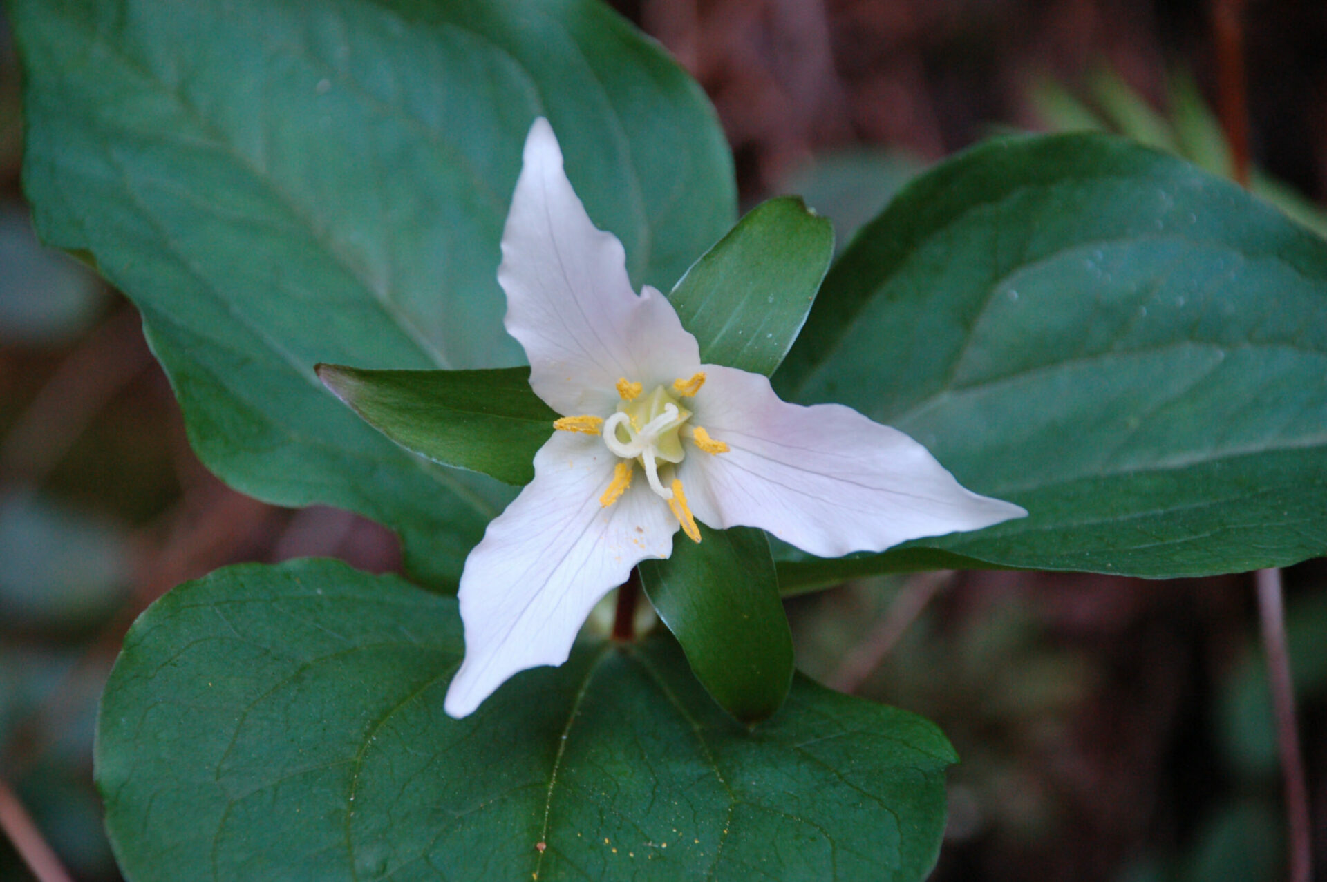
You will find Pacific Trillium in the cooler, shaded side of the mountain, near to where you find the redwood trees (lots of ferns around there, too).
If you click on the lightbox image below you will see larger versions of the photos, and you can scroll through all of the plants (and other things) that we found on this hike. All photos are available for purchase in a variety of formats.


[…] photos for King Mountain in Marin County, California. Read the description and hike details at: King Mountain Wildflowers : California Wildflower Hikes. […]