We hiked to Feather Falls, near Oroville California, in early June 2010. This was in the middle of the “bloom” season. We missed the early flowers, but there still was an exceptional variety. The path is well maintained and fairly easy, but the hike is longer than most we take (about 9 miles round trip) with a fair amount of elevation change.
The weather was excellent – starting at about 65 degrees and warming up to near 80 by the time we finished. Since the elevation is around 2500 feet, it will get warmer if you go later than this in most years. Note that this year we had a cooler, wetter spring, so in other years you may want to pick an earlier time to visit.
The Feather Falls wildflower hike has an added bonus – the falls! This is California’s fourth highest waterfall (sixth highest in the lower 48 states), at 640 feet.
PLEASE NOTE: Due to wildfire damage in 2020, this trail may be CLOSED. Please check the USDA Plumas National Forest website for the current status. You may have to search for “Feather Falls” to find information on this, as the specific website for Feather Falls has been taken down recently.
Note: Click on any photograph to see a larger image
The Hike
This is hike #25 in my favorite hiking guide, Hooked on Hiking: Northern California.
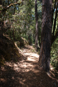
There are two paths that you can take. The upper trail is 4.5 miles to the falls from the trail split, the lower trail is about 3.5 miles. I recommend taking one path out and the other back, as you will see a different selection of wildflowers and scenery. Everyone has their own idea of the best way to go! Leon Turnbull of Waterfalls West prefers taking the longer path out and the shorter back. Larry Matthews of Larry’s Feather Falls prefers the opposite. I overheard some people on the hike saying that the only way they would do it is to take the short hike BOTH ways. My preference is to take the short hike in and the long hike out. The shorter hike is steeper, the longer is an easier grade out. With a long hike of 8 or so miles the easier grade out was appreciated. The scenery (and selection of wildflowers) was different on each side
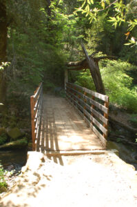
From the overlook at the end of the regular trail there is a path that leads to the top of the falls, which I haven’t taken yet. This is a less developed trail, and the rocks at the top of the falls can be slippery. Please be careful!
Timing is Everything
The weather was excellent – starting at about 65 degrees and warming up to near 80 by the time we finished. Since the elevation is around 2500 feet, it will get warmer if you go later than this in most years. Note that this year we had a cooler, wetter spring, so in other years you may want to pick an earlier time to visit.
The Feather Falls wildflower hike has an added bonus – the falls! This is California’s fourth highest waterfall (sixth highest in the lower 48 states), at 640 feet.
Directions
All roads are paved and easy to travel. There is a fairly large parking lot, although it can be full on busy weekends. Bathrooms are available at the parking lot. This is a very popular hike, so you will see a lot of hikers on the trail.
- From Highway 70 in Oroville, California, take Highway 162 East (Oro Dam Blvd).
- After 1.6 miles, turn right on Olive Highway (still Highway 162).
- Continue for 6.5 miles and then turn right on Forbestown Road.
- Continue for 6.0 miles and turn left on Lumpkin Road.
- Continue for 10.8 miles and look for the sign to Feather Falls (this is Bryant Ravine Rd) – it is fairly obvious. You will turn left at the sign and drive about 1.6 miles to the parking lot at the end of the road.
If you miss the turnoff you will come to the Feather Falls School – turn around…
The Falls
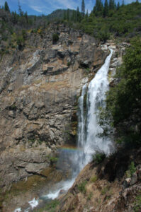
Feather Falls runs all year, but it is best seen (as are all California falls) earlier in the Spring. This is California’s fourth highest waterfall at 640 feet, and the water flow in June was impressive.
At the end of the main trail there is a large observation deck that extends out over the canyon, providing a wonderful view of the falls.
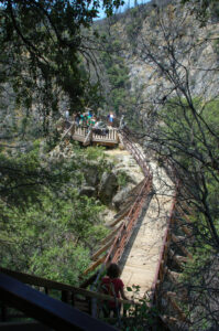
All of the pictures of the falls that I am showing here were taken from the observation deck.
There is plenty of seating here, which is welcome after the 4 or so mile hike to get there.
We were fortunate to time this so we could get a rainbow in the spray at the bottom of the falls.
If you look closely at the pictures you may see people at the very top right of the falls. There is a path that extends from near the observation deck to the top of the falls, which we didn’t try. It wasn’t as well maintained as the trail up to that point.
.
Feather Falls Wildflowers
Please feel free to help me with the identification of any “unidentified” flowers listed here, as well as correcting any errors I may make. Click on any photograph to see a larger image. I’ll start with a few favorites, and then the “gallery”. All pictures were taken with a Nikkor 18-135mm zoom lens.
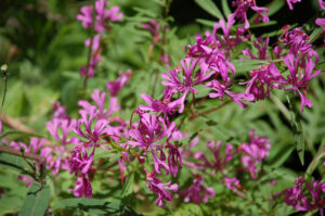
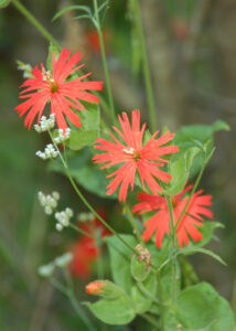
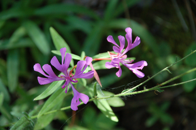
This is the first time I’ve come across Red Ribbons (Clarkia concinna), and there were literally carpets of this in some sections.
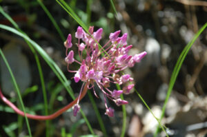
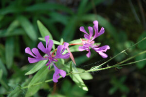
Twining Snake Lily (Dichelostemma volubile) was the most unusual (also a first time find for me), with a long stem that twines up around the other plants nearby.
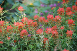
There are many different kinds of Paintbrush and at the time I took this hike I’d not yet learned how to identify the species. I’m not sure why, but they are a special flower to me. It seems that no wildflower hike is complete for me until I find at least one Paintbrush to take a picture of.
If you click on the lightbox image below you will see larger versions of the photos, and you can scroll through all of the plants (and other things) that we found on this hike. All photos are available for purchase in a variety of formats.





Hey Charlie, This will be a great way for me to finally learn the names of CA wildflower~! Thank you. I know it was a lot of work. Cynthia
Very nice Charlie. I love the pics and all the information you provide.
Nice job Charlie. I forwarded your email to Jay.
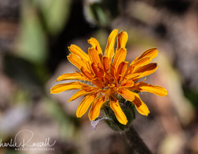
Pretty sure # 2, 3, and 5 are all Common Madia . . The yellow center turns a maroon red with age or after pollination (?) Luv your photos ! Nice work with this page.
The Silene Californica Duran variety I saw was above the Pine Mountain Campground back in the 1970s, located in the PIne Mountain Recreational Community called the Pine Mountain Club. The elevation is around 6,000 to 7,000 feet. These plants were like creeping plants spreading about the ground. The petals were split like an artistic design, cross between a dark pink and orange combination. I have made many artistic oriental style images using this flower when I did graphic arts photography. Today we use digital. Some of the older artistic abilities are not with the same quality as in using graphics arts film, super-imposing images including sandwitching black and white negatives with color negatives. These processes were know as tone line conversions, tone line sparations, and tone separations tone line images combined. These flowers appear to be in a carnation family. This is hard to undersatand especially when they spread like a ground cover. his must be a spacial variety Silene.
The Jepson Herbarium description of Silene californica (now known as Silene laciniata ssp californica) says that the stems can be reclining or decumbent, but that the flowers tend to be ascending to erect