


Oyster Creek is a short and easy trail in El Dorado County, where you can find a good display of wildflowers. If you aren’t ready for the rigors of the more energetic hikes in the Carson Pass area, or if you want to avoid the crowds up there, this is a good alternative. It is a relatively flat hike, you should find wildflowers right at the start, and it is not as well known (i.e. crowded) as the other trails in the area. You won’t get big masses of wildflowers, and not as many of the sub-alpine plants that you see higher up, but it can be satisfying.
This is a simple hike along a creek. The start of the path is a bit hard to find, and the trail sometimes gets a bit lost in the grass. This also is called the Dan Quayle Trail, named after a volunteer who put a lot of time into developing the trail.
The Flowers
Here’s a sample of a few of my favorites from this hike (click on the image to see a larger view). We started this hike late in the day, so there wasn’t a lot of good light, and the quality of some pictures suffered a bit.
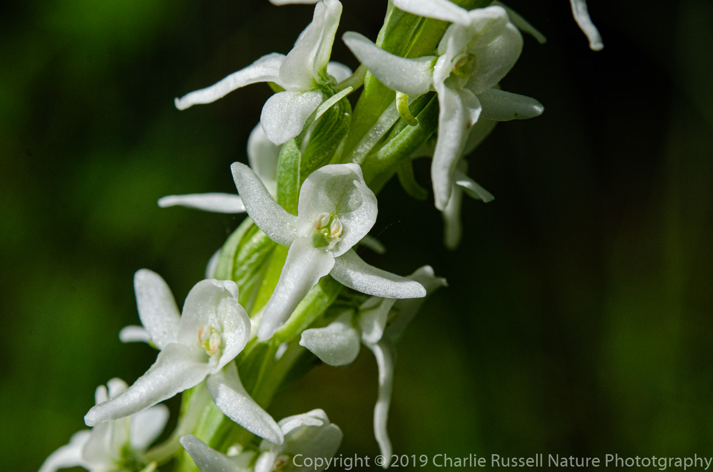
The trail runs along Oyster Creek, so there were quite a few plants that flourished in the riparian habitat. I’m always happy when I find Sierra bog orchids.
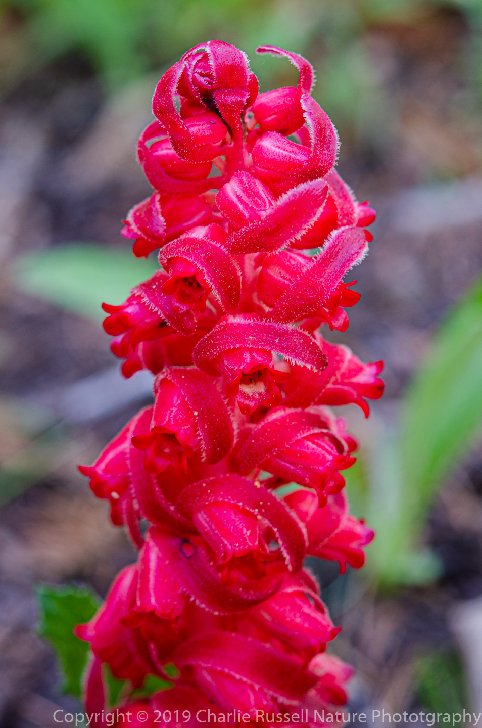
I was surprised to find Snowplants still blooming, in late July! This was a wetter, colder year than usual, so early season plants were still available.
If you click on lightbox image below you will be able to scroll through larger versions of the pictures. All photos are available for purchase in a variety of formats.


")


")


The Hike
This is an out-and-back trail, and for this visit we only went in about 3/4 of a mile. The trail continues further, eventually reaching Silver Creek (the Silver Fork of the American River). I’m told that if you turn let at Silver Creek you’ll come to the “potholes” section, which is popular.
The trail runs along the bank of Oyster Creek. You want to stay on the trail side of the creek, as I believe the other side is private property. On the opposite side of the trail you’ll find a large collection of granite boulders, there may be a different set of flowers up there. Portions of the trail are very damp, make sure you have insect repellent.
Here’s the track that we followed:
Oyster Creek
Profile
Move your mouse along the elevation graph to show the location on the map. The Refresh icon will re-center the map. The Expand icon will expand to full screen.
Directions
The trailhead is roughly 1 mile north of the Silver Lake campgrounds on Highway 88 (5 miles south of Kirkwood). It isn’t marked, and it can be a bit hard to find. You’ll see a turnout on the east side of the highway, just a small paved loop . This used to be either a campground or a rest stop, Google Maps shows it as “Oyster Creek Campground”. Park there and then cross the highway (watch for cars, they come by very fast). There is a rough path that heads north along the highway, just past a few roadside bushes.
After a short distance you will see the path angling off to your left, just before you come to the creek. From here, the path is fairly obvious. We found wildflowers right at the very start, both on the path as well as down along the creek.
Note that some parts of the trail can be a bit muddy in some places as you cross some open areas.
There are no restroom facilities here.
Timing is Everything
This visit was in late July in a year that started off wet and cold. There was still snow on the ground on the Carson Pass trails higher up. The elevation is about 7100′, so I think you normally would be visiting here earlier in July. We found a nice variety of wildflowers, but a very different selection than what you would normally find at the higher Carson Pass trails.
Oyster Creek Wildflowers
Here’s a listing of the native plants that we found on this visit.
- Alpine shooting star, Primula tetrandra
- Anderson’s thistle, Cirsium andersonii
- Arrowleaf Senecio, Senecio triangularis
- Bigleaf lupine, Lupinus latifolius
- California corn lily, Veratrum californicum var. californicum (nif)
- Common cowparsnip, Heracleum maximum
- Crimson columbine, Aquilegia formosa
- Fringed Willowherb, Epilobium ciliatum
- Goosefoot Violet, Viola purpurea
- Meadow beardtongue, Penstemon rydbergii var. oreocharis
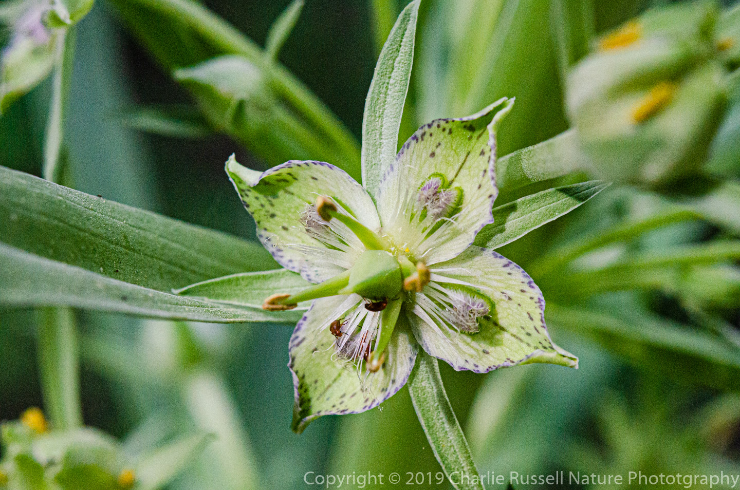
- Monument plant, Frasera speciosa
- Mountain Bluebells, Mertensia ciliata
- Mountain Jewelflower, Streptanthus tortuosus
- Mountain larkspur (aka Sierra larkspur), Delphinium glaucum. streamside
- Narrow-leaf Mountain Trumpet, Collomia linearis
- Roezl’s Penstemon, Penstemon roezlii
- Scarlet Gilia, Ipomopsis aggregata
- Sierra Bog Orchid, Platanthera dilatata var. leucostachys
- Slender cinquefoil, Potentilla gracilis
- Snowplant, Sarcodes sanguinea
- Stickseed, Hackelia species. Possibly Hackelia nervosa, Sierra Stickseed
- Tiling’s Monkeyflower, Erythranthe tilingii
- Toad lily, Montia chamissoi


Add comment