


Every once in awhile you find a little gem, an easy place to find a few beautiful wildflowers without a lot of effort. One such place is the Omega Diggings Overlook, a rest stop on Highway 20. There is a short hike out to a viewing platform that looks out over the South Yuba River towards the old Alpha and Omega Diggings hydraulic mines. The best part of this stop is that there was an abundance of Washington Lilies blooming along the trail, just steps from the parking area.
The Flowers
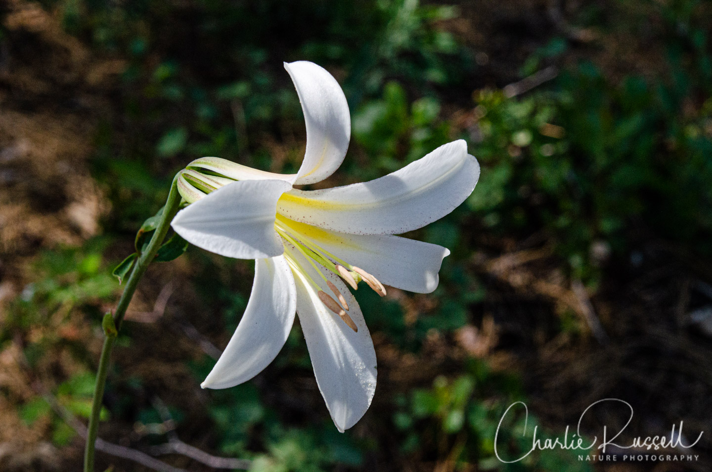
This is a dry, exposed place near the highway, so there weren’t a lot of different wildflowers here. The main attraction was the abundance of blooming Washington Lilies. I’ve never come across so many in one place!

If you click on any of the photos below you will be able to scroll through larger versions of the pictures. All photos are available for purchase in a variety of formats.


The Hike
From the parking area out to the viewpoint was just a quarter of a mile. The trail is paved and reasonably wide, and there is only about a 70′ change in elevation. At the end of the trail there is a structure that extends out over the edge of the ridge, giving you a great view of the area.
Across the valley you are looking at the Omega Diggings, a hydraulic gold mining operation back in the 1850’s. It is adjacent to the Alpha Diggings mine. The town sites that existed there were overwhelmed by the hydraulic mining tailings, and disappeared. You can still see the scars on the hillsides across the Yuba River canyon.
These were some of the largest hydraulic mining operations in the Sierra. River water was diverted into the Omega Ditch and then into wood flumes hung from the granite cliffs above the Yuba River.
Here’s the track that we followed:
Omega Mine Overlook
Profile
Move your mouse along the elevation graph to show the location on the map. The Refresh icon will re-center the map. The Expand icon will expand to full screen.
Directions
The Omega Diggings Overlook is on Highway 20 in Nevada County, about 17 miles east of Nevada City. It is a roadside rest area, with a public restroom. You will see s sign for the overlook trail on the opposite side of the parking area from the highway. It is a loop trail, and the majority of the lilies were inside the loop, just out of view from the parking area.
Timing is Everything
We visited this area in early July of a year that had a wet, cold spring. The elevation is about 5100′. I think that in a normal year you would want to go a bit sooner, perhaps the latter part of June.
Omega Diggings Overlook Wildflower Listing
Here’s a listing of the native plants that we found on this visit. The ones listed in color are endemic to California (that is, found only in California).
- Mountain blue penstemon, Penstemon laetus var. laetus
- Nevada helianthella, Helianthella californica var. nevadensis
- Pine violet (aka Moose horn violet), Viola lobata ssp. lobata
- Torrey’s monkeyflower, Diplacus torreyi
- Washington lily, Lilium washingtonianum ssp. washingtonianum


Add comment